Mark Twain could hardly contain himself in describing his first visit to the lake ...
"At last the lake burst upon us - a noble sheet of blue water lifted 6300 feet
above the level of the sea, and wailed in by a rim of snow-clad mountain
peaks that towered aloft 3000 feet higher still! It was a vast oval... As it lay
there with the shadows of the mountains brilliantly photographed upon its still
surface, I thought it must surely be the fairest picture the whole earth
affords."
Facts:
Lake Tahoe is the largest alpine lake in North America and the 2nd deepest (1,645 ft (501 m).
The lake is 99.1 percent pure and known for its remarkable clarity and cobalt blue color.
Lake Tahoe is the second deepest lake in the United States and the tenth deepest in the world, with a maximum depth measured at 1,645 ft (501 m), average depth of 1,000 ft (305 m). Crater Lake in Oregon is the deepest lake (1,949 ft or 594 m) in the United States.
the lake holds nearly 156 km
2 or 39 trillion gallons of water. The water in Lake Tahoe could cover a flat area the size of California 14 in (36 cm) deep.
It is 12 miles wide and 22 miles long.
Surface area is 122,317 acres, or 191 square miles
It takes,
on average, 650 years for water that enters the Lake to leave the Lake. [This is a long time. For example Lake Michigan's retention time is 99 years.]
The lake is 99.1 percent pure and known for its remarkable clarity. At times, it can extend to 75 ft.
Lake Tahoe is about 22 mi (35 km) long and l2 mi (19 km) wide and has 72 mi (116 km) of shoreline and a surface area of 191 mi2 (495 km2). The floor of the Lake Tahoe Basin is at an elevation of about 4,580 ft (1,396 m), which is lower than the surface of the Carson Valley to the east! With an average surface elevation of 6,225 ft (1,897 m) above sea level, Lake Tahoe is the highest lake of its size in the United State.
The water temperature near the surface generally cools to 40 to 50°F (4.5 to 10°C) during February and March and warms to 65 to 70°F (18 to 21°C) during August and September. Below a depth of 600 to 700 ft (183 to 213 m), the water temperature remains a constant 39°F (4.0°C).
A UC Davis study found that from 1969 to 2002 the average water temperature increased 0.88 degrees Fahrenheit (0.5 degrees Celsius).
The average July surface water temperature has increased almost five degrees, from 62.9 degrees F. to 67.8 degrees F., from 1999 to 2007.
Source: Facts about Lake Tahoe at the USGS
Lake Tahoe never freezes due to the depth and constant movement of water from the bottom to the surface although some protected areas such as Emerald Bay have been covered with a layer of ice.
The lake is fed by 63 streams and two hot springs. The Truckee River at Tahoe City is the only outlet for the lake, which eventually feeds northeast into Pyramid Lake, never reaching an ocean.
Precipitation varies by location. The Sierra rain shadow causes yearly precipitation to decrease as one moves east. Donner summit in the north and Echo summit in the south can get 80 in. per year. Carson City over the mountains to the east gets only 25 in. per year. Precipitation ranges from 40 inches per year (in/yr) on the eastern side to 90 in/yr on the western side according to the 1999 USGS Fact Sheet 035-02. The precipitation total in 2006 was 48.4 inches. That is 84 percent higher than the annual average measured in 2001 through 2005, which was 26.3 inches
according to the 2007 Tahoe Status Report from UC Davis' Tahoe Environmental Research Center (TERC).
The snow to liquid equivalent is the amount of liquid precipitation that is produced after melting snow. It can range from 5:1 for wet snow to 30:1 for extremly dry snow. 10:1 is the commonly used ratio.
The number of days with average air temperatures below freezing has dropped from 79 days to 52 days from 1911 to 2007. The percentage of snow in the total precipitation has decreased from 52 percent to 34 percent since 1911.
The only fish truly native to this area is the Lahontan cuthroat trout, though mackinaw, rainbow trout and kokanee salmon also inhabit Tahoe. Non-natives were introduced as early as the mid-1800s to provide food for miners as the Lahontan fishery was drastically depleted.
Why is it so blue?
Tahoe called the "Lake of the Sky", with its brilliant shades of blues, however the blue color isn't because of the blue sky. When the sky was gray from fires in in the Sacramento valley in 2008 the lake was still very blue. The common knowledge was:
It's blue because of it's clarity. Water absorbs all colors of light except blue. The further through water light travels the more other colors are absorbed. Because it is so clear, light is not reflected back until most other colors are absorbed.
In 2015 researchers found that low levels of alge were more responsible for the blueness than the clarity.
See Lake Tahoe Blueness Not Related to Clarity - YouTube
Clarity:
One reason for the clarity is that 38 % of the precipitation falling into the Lake Tahoe Basin falls directly upon the Lake (It has a watershed-to-lake ratio of only 1.6:1, much
smaller than the 10:1 value found for a typical watershed.) Of the remaining precipitation a significant amount falls on granite and decomposed granite, so picks up little pollution (nutrients and particulate matter) and drains through the marshes and meadows, which are a good filtering system for water. Another contributing factor is exportation of all sewage from the Basin.
33% of the pollution comes from the Tahoe Keys at the South Shore.
UC Davis researchers at the Tahoe Environmental Research Center, measure the lake's clarity every seven to 10 days by lowering a white, dinner-plate-sized disk (called a Secchi disk) into the water at fixed locations and noting the depth at which the disk disappears from sight.
In 1968, when Secchi measurements began, the disk could be seen at an average depth of 102.4 feet. It is now about 72 feet.
Conservation and Development
See Tahoe Conservation
NW Tahoe - Truckee - Donner Development
Snowfall:
Average total snow fall at lake level is 14 ft. accumulating to a maximum depth of 2.8 ft.
The maximum depth at the Tahoe City SNOTEL monitoring station for 2004-2009 ranged from 4' to 5'-10".
Ski areas report average snowfall of 24-38 feet.
See Weather.
Population: 20,000 in 1960 to more than 65,000 in 2003
Links:
Tree Species
Tahoe History and Geology.
Dangers (bears, rattlesnakes, ticks, mountain lions, poison oak)
Facts about Lake Tahoe at the U.S. Geological Survey
Facts at RubiconBay.net
Historical Lake Levels at BoatTahoe.com
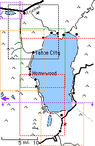
|  Maps
Maps