Zoom Out Google Map
| Pass - Road | Elevation |
|---|---|
| Truckee River - Hwy 89N Tahoe Outlet | 6,230' |
| McKinney-Rubicon Rd. jeep trail | 7,127' |
| Spooner Summit - Hwy 50E | 7,146' |
| Brockway Summit - Hwy 267 | 7,199' |
| Donner Summit - Hwy 80 | 7,239' |
| Daggett Pass - Hwy 207 | 7,334' |
| Echo Summit- Hwy 50W | 7,382' |
| Luther Pass - Hwy 89S | 7,735' |
| Barker Pass Blackwood canyon Rd. | 7,780' |
| Mt. Rose Summit- Hwy 431 | 8,933' |
 South to Yosemite
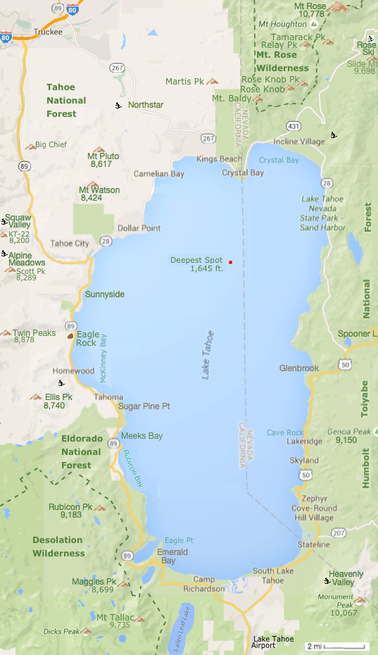
Lake Tahoe is the second deepest (1,645 ft) lake in the United States and the tenth deepest in the world.
Only Crater Lake in Oregon is deeper (1,946 ft) in the US.
Tahoe is 12 miles wide and 22 miles long.
The water in Lake Tahoe could cover a flat area the size of California 14 in deep.
NOAA Depth Chart