 Martinsville
Washington Valley Park
South East Maps
Martinsville
Washington Valley Park
South East Maps
 North East Main Washington Valley Park page
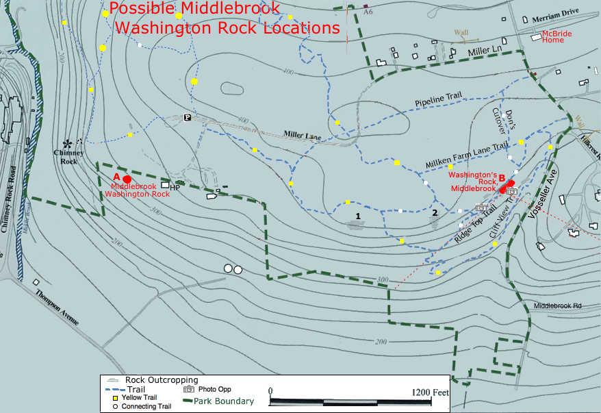
 West
WestMiddlebrook Washington Rock Another Washington Lookuout - Identified in "Revolutionary New Jersey"
McBride's Rock another probable Washington Lookout
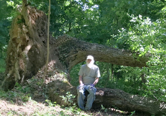
Line Tree
- A tree shaped with 3 forked trunks (fallen now)
Fireplace Rock - Approximate site of Revolutionary War Signal Tower
McBride Rock Another Washington Lookout site
Chimney Rock
Park Service map | Larger map to Chimney rock | Combined wide map.
Middlebrook Encampment
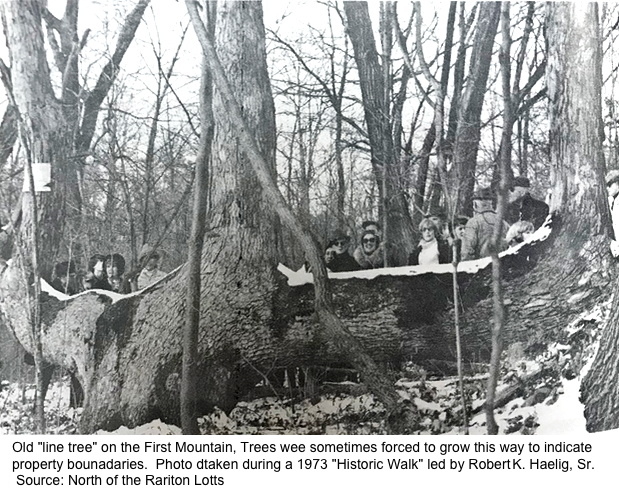 Line Tree, Marker Tree, trail tree:
There was a big tree at the spot marked on the map above that was shaped with 3 trunks.
North of the Rariton Lotts: a history of the Martinsville, New Jersey area captions it.
Old "line tree" on the First Mountain, Trees were sometimes forced to grow this way to indicate property bounadaries. Photo taken duing a 1973 "Historic Walk" led by Robert K. Haelig, Sr.The web pages below say they were also made by Native Americans.
I've counted the growth rings in a section that was cut after it fell which indicates it was from the early 1900's.
The native american trees were called "marker trees," or "trail trees," saplings were carefully bent by a local Native American tribe over 100 years ago, forcing them to grow in unnatural shapes.
They could have marked the boundary between two tribes or mark trails or other special locations.
It blew over in Hurricane Sandy in 2012.
These Trees Have Secret Native American Codes. Their Meaning? Brilliant!
What Is An Indian Marker Tree, And How Were They Used?
"marker tree" - Google Search
Fireplace Rock:
Approximate site of Revolutionary War Signal Tower (Signal Beacon).
It's shown as Fireplace Rock on the Boom Map
See Signal Beacons
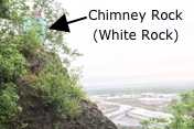 Chimney Rock:
Sight of the Washington Valley Hawk Watch
Return to: Wash Valley Park