Don's Home Places World United States Contact
Under Construction

United States


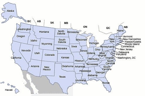
Regions - Divisions (Census bureau: - % of population, Rate = growth rate)
Region % Rate Division States
Northeast 18% 0.3% New England Connecticut, Maine, Massachusetts, New Hampshire, Rhode Island, Vermont
Middle Atlantic New Jersey, New York, Pennsylvania
Midwest 22% 0.4% East North Central Illinois, Indiana, Michigan, Ohio, Wisconsin
West North Central Iowa, Kansas, Minnesota, Missouri, Nebraska, North Dakota, South Dakota
South 37% 1.3% South Atlantic Delaware, District of Columbia, Florida, Georgia, Maryland, North Carolina, South Carolina, Virginia, West Virginia
East South Central Alabama, Kentucky, Mississippi, Tennessee
West South Central Arkansas, Louisiana, Oklahoma, Texas
West 23% 1.4%Mountain Arizona, Colorado, Idaho, Montana, Nevada, New Mexico, Utah, Wyoming
Pacific Alaska, California, Hawaii, Oregon, Washington
See:
Census Bureau Region, Division and State Codes
Population Migration
Latitude - Longitude

Cities
Population: Growth Rates, Immigration, etc. here, States, Census Bureau, (Population Growth map)
Maps: National Atlas from the USGS (Interactaive version), U. Texas, U.S. Metropolitan Areas at UT, CIA Factbook, Red & Blue states 2000 election, States at Enchanted Learning.
Color Landform Atlas at Johns Hopkins
Teritorial Maps 1775 - 1920
NetState
Highest and Lowest point in each state at FactMonster
Travel Information at: Lonely Planet, USA at Yahoo Travel, Virtual Tourist, rec.travel, CitySearch, Insiders Guide

National Park Reservations
Counties by State

Demographics:
Best Places to Live
Median Household Income by county, Place (City)
Murder Rate by City
Other Demographics

Other
See: 50States.com


Dependent Areas:
American Samoa, Baker Island, Guam, Howland Island, Jarvis Island, Johnston Atoll, Kingman Reef, Midway Islands, Navassa Island, hern Mariana Islands, Palmyra Atoll, Puerto Rico, Virgin Islands, Wake Island

note: from 18 July 1947 until 1 October 1994, the US administered the Trust Territory of the Pacific Islands, but recently entered into a new political relationship with all four political units: the Northern Mariana Islands is a commonwealth in political union with the US (effective 3 November 1986); Palau concluded a Compact of Free Association with the US (effective 1 October 1994); the Federated States of Micronesia signed a Compact of Free Association with the US (effective 3 November 1986); the Republic of the Marshall Islands signed a Compact of Free Association with the US (effective 21 October 1986)


Some Demographics:
Income Inequality among America's Children at the Urban Institute
Obesity, Inactivity and Poverity by state
Population by state
US Population growth
Disparity of Income

Return to Don's Home.

last updated 12 Jan 2009
Alaska Washington Oregon Idaho Montana Wyoming California Nevada Utah Arizona Colorado New Mexico North Dakota South Dakota Nebraska Kansas Oklahoma Texas Minnesota Iowa Missouri Arkansas Louisiana Wisconsin Illinois Michigan Indiana Kentucky Tennessee Mississippi Ohio West Virginia Alabama Florida Georgia South Carolina North Carolina Virginia Hawaii District of Columbia Maryland Delaware New Jersey Connecticut Rhode Island Massachusetts New Hampshire Vermont Maine New York Pennsylvania New Hampshire Vermont Massachusetts Rhode Island Connecticut New Jersey Delaware Maryland