|
Fourth of July 2010 on Mt. Tallac. Tom McBride, Don McBride, Ollie A local tradition for Tahoe west shore residents is to go up to Mt. Tallac (9,735') and watch the fireworks at Tahoe City, Incline Village, Glenbrook and State Line. (Camp Richardson also had some private fireworks in 2010). Locals usually do it when there is a near full moon, but my son Tom, his dog Ollie, and I did it in 2010 when we were in the last quarter of the moon which didn't come up until about 2 AM.
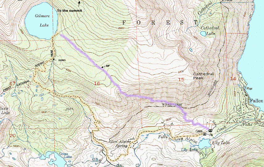
We went up an uncharted (Middle Tallac Trail) (shown on the our map from the GPS track we did).
Paul McCulloch of the Forest Service's Backcountry Information Center at the Taylor Creek Visitor's Center told us about it just before we left. We GPS'ed the route at his request sent him the file in addition to putting it on my Tallac web page. 2010 was the heaviest spring snow year in recent memory, so we had some snow crossings which obscured the trail, but made it OK. We had plenty of time to relax (should have brought some reading). There were two other groups when we got there. and one guy showed up shortly after us with his dog. He'd been hiking in the Desolation Wilderness for several days and complained that he couldn't fish at Lake Aloha because it still had ice on it. As the sun went down we were a little cold (had 3 layers, but no down or fleece), but had a big sandwich from PDQ, M&M peanuts and plenty of other energy food, to burn. By the time the time the fireworks started, about 9:30-9:45, there were about two dozen people, a couple of forest service rangers and a half dozen dogs. Fireworks were great. We started down with the mob, many of whom were camping at Gilmore Lake. Not too far from the top Ollie cut a pad on her paw and couldn't continue. We consolidated all our gear into one pack and put Ollie (about 25 lbs.) into the other pack which we mounted in front and took turns carrying her.
When we got to Lake Gilmore we decided not to return on the shortcut (which we had plotted on our GPS) but included some narrow (6") paths on steep rocky terrain and to follow the standard Lake Gilmore to Glen Alpine trail. We had trouble finding the trail from Lake Gilmore, the Garmin GPS and TOPO! CD maps showed the the Glen Alpine Creek crossing 500 ft. below Gilmore L. where because of high water from the snow melt it was impossible to cross. We started going up and downstream trying to find a crossing. After about 30 minutes of this one of our headlamps started to fail because of weak batteries and a backup light failed because of electrical problems. The GPS batteries also ran down and the spare pair said they were dead.
We sat down took a deep breath, put Ollie down and solved two problems:
We decided to continue; We switched the one good headlamp from the 1 watt spot to 3 LED flods to double the battery life (It turned out we had plenty of power the 1 W spot will run for 50 hours). It was a tough trip down trying to avoid ankle sprains from steps and rocks on the trail which we could not see because of bad lighting. And we did not want to dump Ollie on her head. We were happy to hit the bike trail at Glen Alpine Springs about the time the moon rose which gave us a smooth trail back to the car where we arrived at 2:30 AM. We got back our cabin at Homewood at 3:30 and scarfed down the food Marty had left for us. An adventure for the top 5 list.
Key Learnings:
From the top of Mt. Tallac (9,735') |

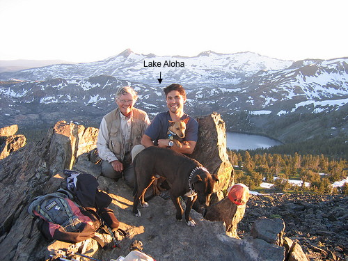 Looking southwest over Gilmore Lake toward the
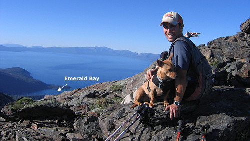
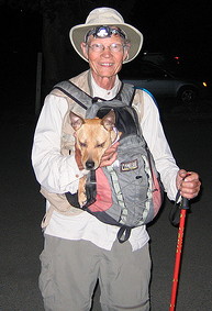 Tahoe 2:30 AM - The End