Under Construction 
There are basically two types of pocket sized devices which use the GPS system to determine your location and satellite uplinks to dispatch emergency rescue services when you are out of cell phone range.
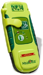
- PLBs - A scaled down version of the EPIRB (Emergency Position Indicating Radio Beacon) and ELT (Emergency Locator Transmitter) that boaters and pilots use to transmit your GPS coordinates and dispatch emergency services via the worldwide COSPAS-SARSAT emergency GEO satellite system.
Unit cost: $300-600
Registration: Free
- SPOT™ Personal Tracker (original) / SPOT™ Satellite GPS Messenger (new) - Uses the LEO Globalstar satellite system to send your GPS coordinates along with 3 kinds of messages to either 1. Notify 911 emergency, 2. Ask for help from friends, 3. Send an OK message with your location to friends.
Unit cost: $150
Basic Service: $100/yr.
Tracking Service: Additional $50/yr.
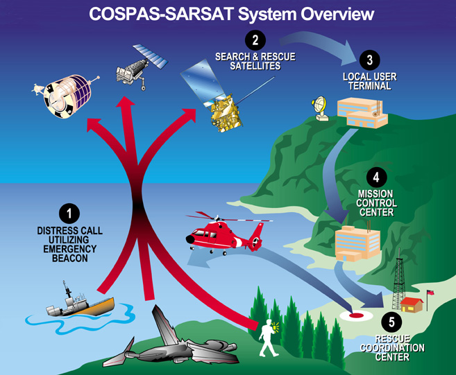
 Features of 406 MHz PLBs
- Has a 12-channel GPS receiver to get your position.
- When activated it transmits your location via a 5 watt signal to the worldwide COSPAS-SARSAT satellite system on the 406 MHz band.
- Notification every 20 min.
- The transmission of a 121.5 MHz homing signal was scheduled to be phased out in 2009.
- You register it with the NOAA
- Category I EPIRBs used by boaters are automatically activated when immersed in water.
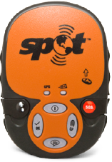 SPOT™ Personal Tracker
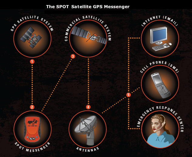
Transmits your location via a 0.4 watt signal to Globalstar LEO satellite system on the 1.6 GHz L-band which then, depending on which button you press, sends it to a 9-1-1 dispatch center or to your contact list via email or SMS message to a cell phone with a help or OK message.
- North American Alert 9-1-1
Dispatches emergency responders to an exact
location (United States/Canada).
- Worldwide Alert 9-1-1
Dispatches emergency responders to an exact
location outside North America (GEOS rescue service).
- Ask for Help
Sends a request for help to a customized list of
recipients (via SMS or email).
- Check In - SPOTchecking Service. Lets contacts know where
you are and that you are okay (via SMS or email).
- Custom Message - Same as check-in but with a different message (new in GPS Messanger)
- Track Progress - SPOTcasting Service. Sends and saves your location on
Internet site every 10 minutes to view progress using Google Maps. Requires an additional service fee $50/yr.
- GEOS Search and Rescue (SAR) program is available for $8 at the time of SPOT registration.
Some people have criticized SPOT because it uses the Globalstar satellite system to send messages up. Globalstar has had some reliability problems, some of which have been corrected. Also, SPOT only uses the simplex transmitter which is more reliable than the duplex system used with the satellite phones.
SPOT Satellite GPS Messenger. - New version:
- 30% smaller and lighter than the original model at 5.2 ounces.
- New enhanced satellite antenna for improved performance in foliage or canopied environments and Advanced GPS performance chipset.
- GPS Acquisition light and “Message Sending” indicator light .
- Dedicated GPS Tracking button.
- New, dedicated pre-programmable Custom Message button.
- Protective covers over S.O.S and Help button to prevent inadvertent message transmissions.
- Illuminated buttons.
The Spot Gen3 is the newest version.
See:
SPOT 1 Notes
Second Generation SPOT Satellite GPS Messenger Introduced | Doug Ritter’s Equipped.org Blog
Outdoor Emergency Field Communications | Outdoor Safety Institute
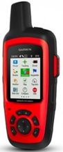 Garmin InReach (was Delorme)
Send text messages (two-way)
Maps and tracking with Earthmate app on your mobile device.
Glossary:
ACR - ACR Electronics - Mfg. of PLBs
COSPAS - Cosmicheskaya Sistyema Poiska Avariynich Sudov,
    (Space System for the Search of Vessels in Distress)
    Owned by USA, Russia, France, and Canada
DASS - Distress Alerting Satellite System
EPIRB - Emergency Position Indicating Radio Beacon - Boaters
ELT- Emergency Locator Transmitter - Pilots
GEO -  Geosynchronous or Geostationary Satellites - 22,000 mi. high
GEOS - GEOS Search and Rescue (SAR) program
GOES - Geostationary Orbiting Environmental Satellite
GPS - Global Positioning System. 24 satellites circling at 12,000 mi. with 2 orbits/day.
IBRD - International 406 MHz Beacon Registration Database
LEO - Low Earth Orbit Satellites- 200-950 miles high
LUTs - Local User Terminals - Satellite receiving stations
MCC - Mission Control Center
NOAA - National Oceanic and Atmospheric Administration.
PLB - Personal Locator Beacons
RCC - Rescue Coordination Center
SAR - Search and Rescue
SARSAT - Search And Rescue Satellite Aided Tracking
SOCC - Satellite  Operations Control  Center
SPOC - Search and Rescue Points of Contact
USMCC - U.S. Mission Control Center (MCC)
See: NASA Search and Rescue Mission Office : DASS : Acromyms
Retailers:
Personal Locator Beacons at REI.com
Links:
The Best Personal Locator Beacon and Satellite Messenger | OutdoorGearLab
Best Satellite Messengers and Locator Beacons of 2017 | OutdoorGearLab
Top 5 Locator Beacons of 2017 | Video Review
Satellite Coverage: Globalstar Corporate
Case Study - Alaska Bear Attack
Longitude and Latitude U.S.
Best EPIRBs and Personal Locator Beacons
Emergency Personal Locators--Spot Satellite Messenger
Comments at BackCountry.com/
Personal Locator Beacons (PLBs) Approved in U.S. - EQUIPPED TO SURVIVE (tm)
Negative Reviews:
Review of SPOT at BackpackingLight.com, Jan 2008
Return to Products
last updated 22 Dec 2009
|  Products
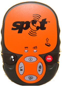 SPOT™ Personal Tracker