|
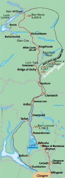
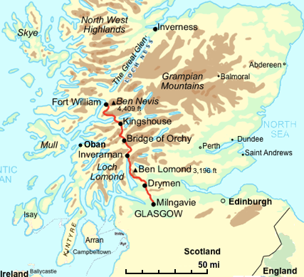
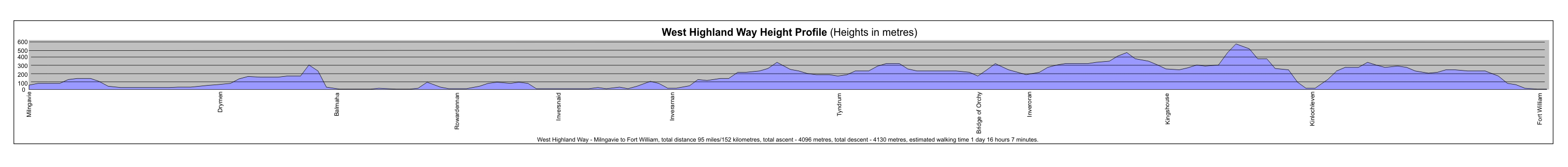
Scotland's first official long distance route links Milngavie to Fort William - a distance of 154km (96 miles) - from the northern outskirts of Glasgow, to the foot of Ben Nevis at Fort William.
The terrain ranges from lowland moors, dense woodland and rolling hills, to high mountainous regions in the Scottish Highlands. These environments provide habitats for a diverse range of wildlife species, both flora and fauna.
Much of the Way follows ancient and historic routes of communication and makes use of Drove Roads, Military Roads and Disused Railway Tracks.
There are many route options from 5 to 9 days. See Easyways - West Highland Way Route Options.
The West Highland Way can offer all types of accommodation including wigwams, bunkhouses, youth hostels, b&bs, inns, guest houses and hotels. However, it should be noted that not all types are available at every stage.
There are booking services (see below) to help you arrange a trip or preplanned trips with organizations like the Sierra Club.
It is usually done South (Milngavie) to North (Fort William), but can be done the other way. The official start of the West Highland Way is a granite obelisk in Douglas Street, Milngavie.
 Following is an example of a 9 day itinerary.
| Dy | Section | Dist.
(mi) | Ascent
(ft) |
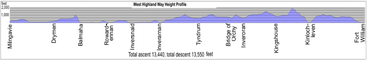
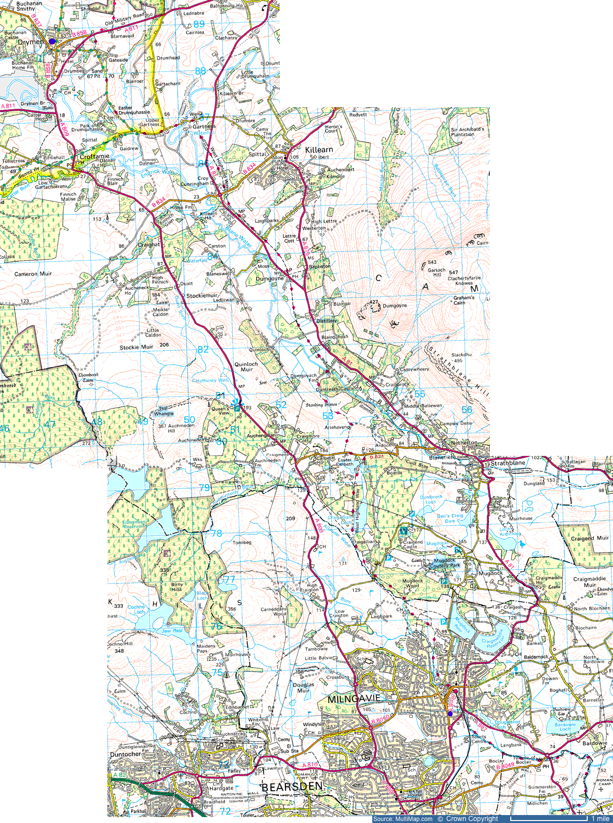
| 1 | Milngavie to Drymen  17x23 17x23 | 12 | 500 |
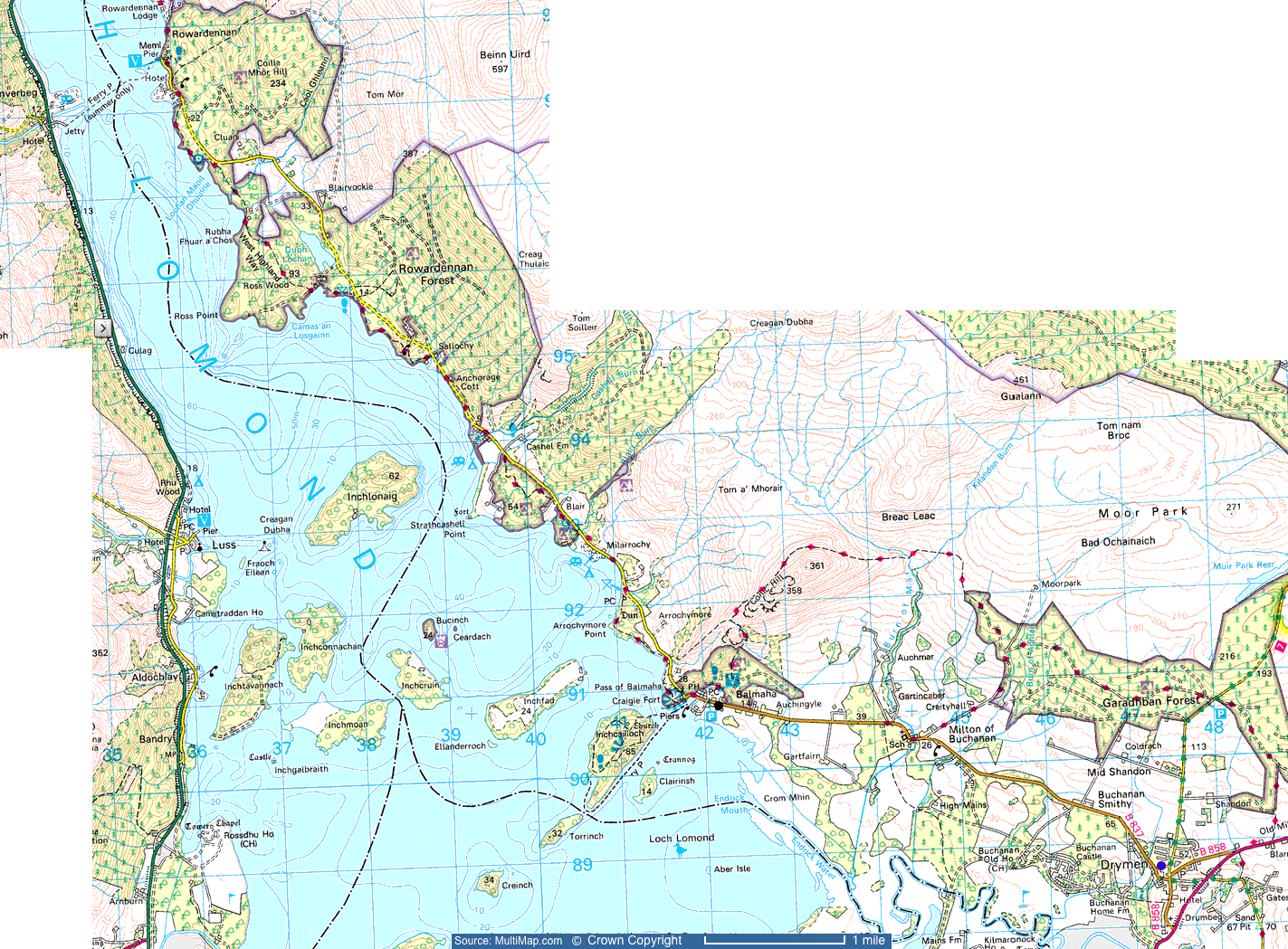
| 2 | Drymen to Balmaha 20x15 | 8 | 1,200 |
| 3 | Balmaha to Rowardennan 20x15 | 7 | 1,200 |
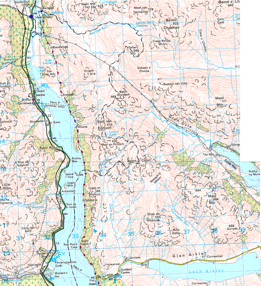
| 4 | Rowardennan to Ardlui Boat dock
row-invrsn 12.2x15.6 invrsn - invern 12x13.5 | 12 | 1,785 |
| 5 | Ardlui to Tyndrum 15.5x21 | 14 | 1,270 |
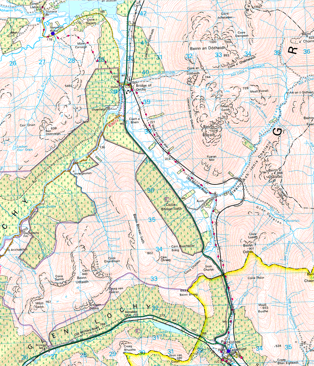
| 6 | Tyndrum to Inveroran Hotel 14x16.5 | 9 | 1,225 |
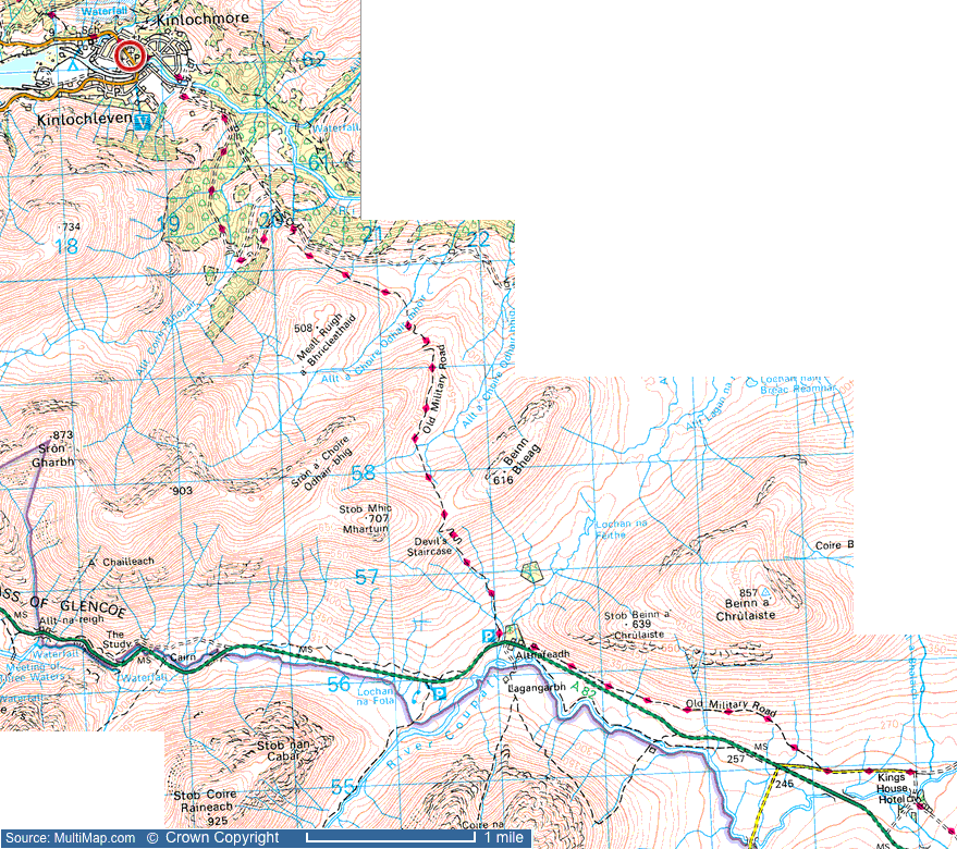
| 7 | Inveroran Hotel to Kingshouse Hotel 12x21 | 10 | 1,700 |
| 8 | Kingshouse to Kinlochleven 12.2x11 | 8 | 1,388 |
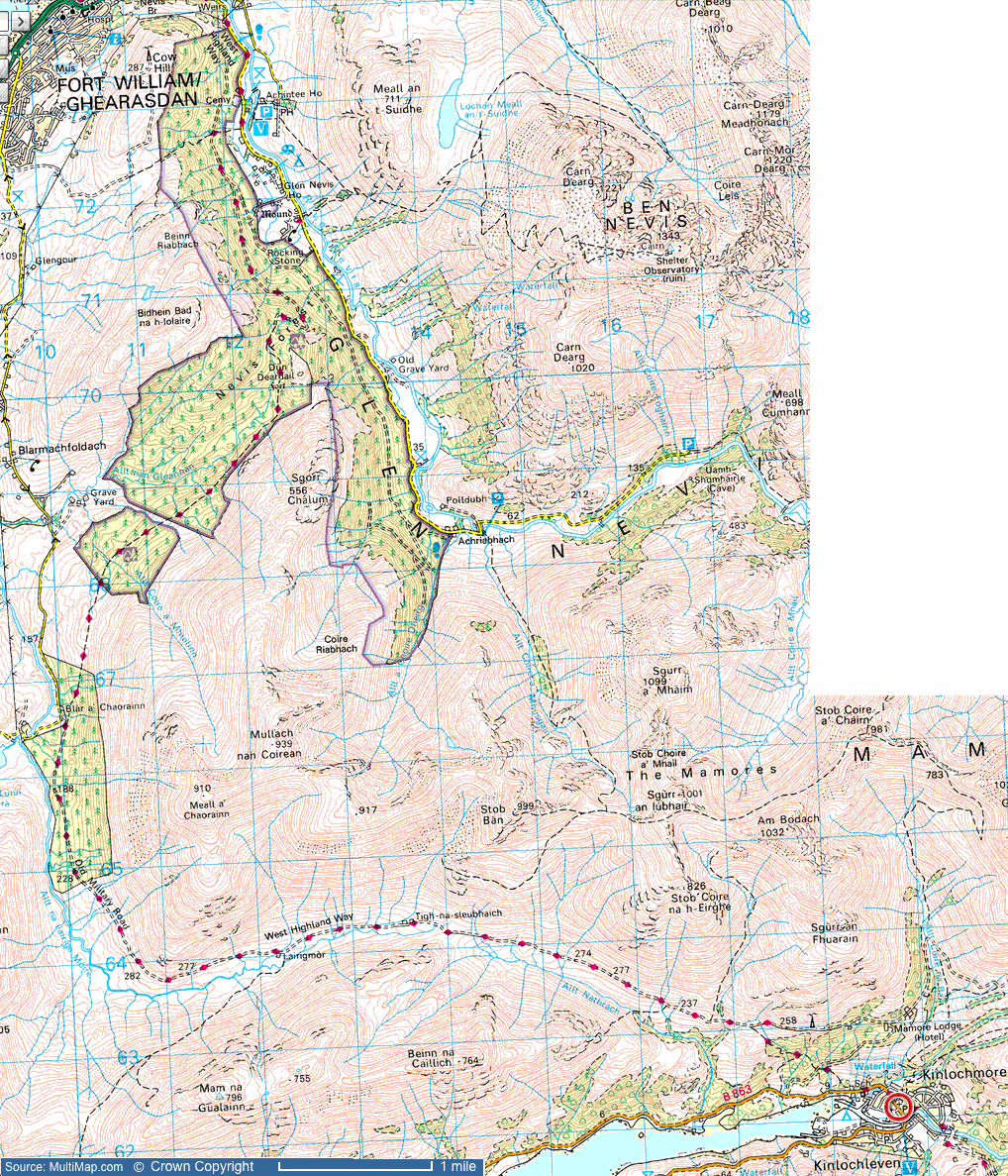
| 9 | Kinlochleven to Fort William 14x16.5 | 15 | 2,400 |
| Total | 95 | 12,668 |
Sources: Dan's Adventure Map at HarryRabbit.co.uk
Maps: Google, multimap, Map at HarryRabbit.co.uk, Scotland '89 : The West Highland Way, Ordnance Survey Maps
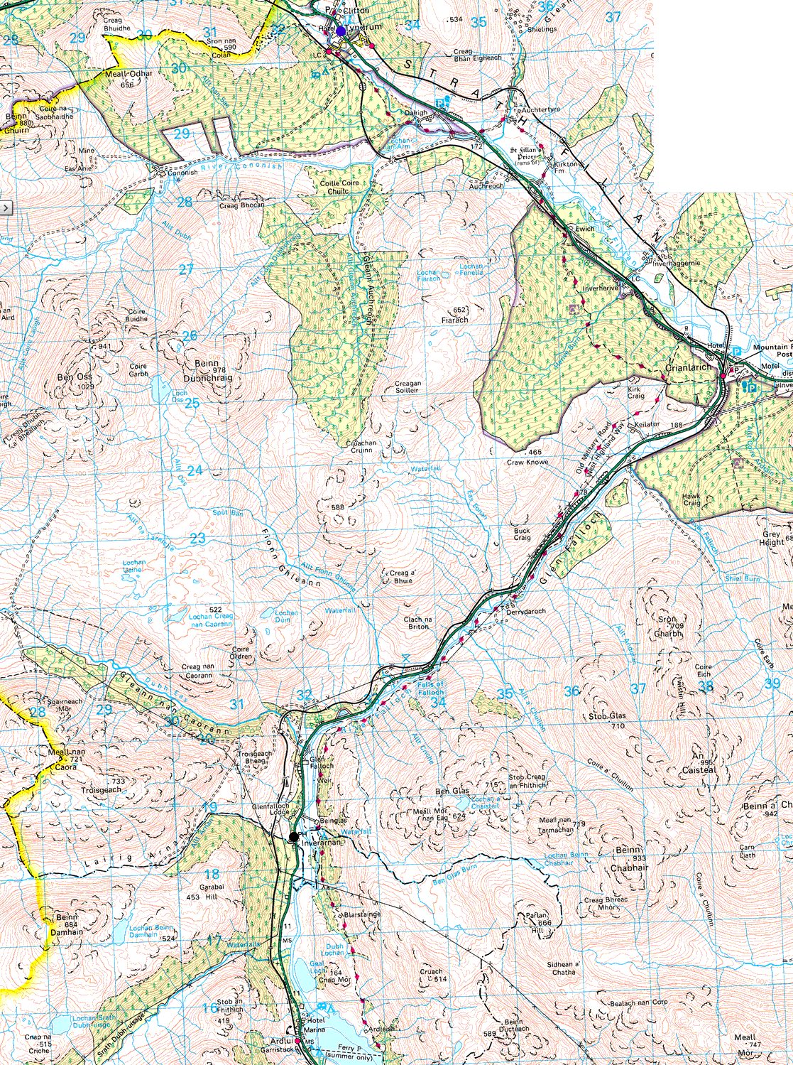
Tyndrum to Fort William | Loch Lomond
Source: The West Highland Way, By The Way at TyndrumByTheWay.com
This 92 mile national long-distance trail through the south-western part of the Scottish Highlands, starts at the village of Drymen just outside Glasgow, it includes large sections of Loch Lomond, valley routes through the mountains round Crianlarich and open heather moorland across the Rannoch Moor wilderness area. It passes close to sombre Glencoe, famed for its massacre of the MacDonald Clan, and finishes at Fort William near the foot of Ben Nevis, (Britain's highest peak, which can be readily ascended if you choose to spend an extra day in Fort William at the end of your walk). The West Highland Way is a well established and popular route. The altitude range is from sea-level to 1850 ft (4408 ft if Ben Nevis is climbed).
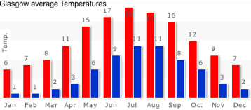
Weather:
Conversion C to F
| °C | 0 | 5 | 10 | 15 | 20 | 25 | 30 | 35 |
| °F | 32 | 41 | 50 | 59 | 68 | 77 | 86 | 95 |
 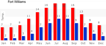 Forecast at Mountain Weather Information Service | BBC Weather | the weather channel
Midge forecast
Safety:
Dial 999 and ask for police in case of an injury.
See: Mountain Skills and Safety (Walk Highlands)
shopping - Stores
Services at West Highland Wayfarer
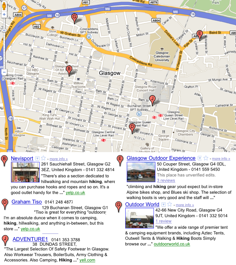
Hiking Stores in Glasgow:
map here
Google Map w/ Hiking and Camping stores
Books:
"The West Highland Way" by Terry Marsh (a Cicerone guide)
"The West Highland Way: Official Guide" by Roger Smith.
Links:
Scotland '89 : The West Highland Way
The West Highland Way, Milngavie, Fort William, Walking in Scotland at west-highland-way.co.uk
West Highland Way Feature Page on Undiscovered Scotland
Easyways - West Highland Way Route Map
2010 Sierra Club Outing
The West Highland Way at VisitScotland.com
BAIRD`S TRAVELS IN BONNIE SCOTLAND - MAP OF WEST HIGHLAND WAY - Worldisround photo
Walking Scotland - The West Highland Way Rambler - Rowardennan to Inversnaid
Inversnaid, a poem by Gerard Manley Hopkins
west highland way 2011 - skippers
Travel:
By Train: The best and easiest option. Trains run alternately from Glasgow Queen Street and Glasgow Central Stations to Milngavie every 15 minutes. The journey takes about 20 minutes and costs under £5.
By Bus: A couple of bus services run from Glasgow City Centre to Milngavie. Expect the trip to take 40 minutes.
Travel back to Glasgow is more limited. Three trains daily depart from Fort William to Glasgow and the trip takes about 4 hours (5 hours if going to the airport by train). Departure times are 7:42 AM, 11:40 AM and 5:37 PM. If you would like to book your train ticket ahead of time or would like to look at train schedules, you can visit www.thetrainline.com If you purchase tickets online about 30 days before you travel, you can often save up to 50 percent over the same day fare.
Bus' from Fort William to Glasgow only take about three hours and runs about £22. Scottish Citylink bus departs Fort WIlliamat 11 AM and 2 PM. If you would like to book your bus ticket ahead of time or would like to look at bus schedules, you can visit www.citylink.co.uk
Accommodations - Booking and transportation Services:
Summary of options at at west-highland-way.co.uk
Sierra Club Outings | Mountains, Lochs, and Glens: The West Highland Way, Scotland.
The Sherpa Van Accommodation Service
Easyways
Travel-lite - Baggage Delivery
Bugs:
Midges are small nat-like bugs 1 mm long that are a big problem in the Western Scottish Highlands.
Search for Midge repellent.
Health and Care Services:
The nearest services are GPs in Drymen, Killearn and Balfron. Hospitals in Stirling and Glasgow; dentists in Alexandria and Balfron. Drymen Health Centre dispenses their own prescriptions otherwise the nearest dispensing pharmacies are in Killearn and Balfron.
last updated 9 Sep 2010
|
 Places

