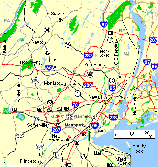
NE. NJ
|
Use Out of State Directions
See Martinsville Info and North New Jersey Info also.
Note: Mileages are approximate.
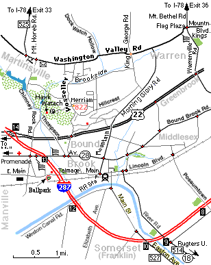
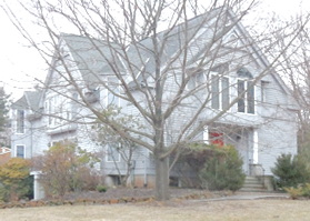
822 Vosseller Ave. Martinsville
Corner of Vosseller and Merriam Dr. - Driveway is on Merriam.
From the north (Basking Ridge, Liberty Corner):
- Take Mt. Airy Rd. from 287 or Lyons Rd. from basking ridge and turn LEFT on Mt. Airy.
- Contiune across Vally Rd. onto Martinsville-Liberty Corner Rd. Rt. 525
- Follow Rt. 525 (Martinsville - Liberty Corner Rd, then Mt. Horeb Rd. South)
across I-78 until it ends at a T (3 mi. from I-78).
- [TURN LEFT] at Washington Valley Rd.
- After 1.1 mi. [TURN RIGHT] on Vosseller Ave.
- After 1 mi. [TURN LEFT] on Merriam Dr.
- 822 is first driveway on the right
From the west (I-78 Clinton):
- Take I-78 East to exit 33 (Martinsville)
- [TURN RIGHT] onto Martinsville-Liberty Corner Rd and follow directions above.
From the north-east (Newark Airport, Summit area):
- From the Airport
- Follow I-78 West to Exit 36 (Warrenville, Basking Ridge).
- [TURN LEFT] left onto King George Rd. towards Warrenville.
- Proceed 2.9 mi. (The road changes to Mt. Bethel) at the Flag Plaza shopping center [TURN RIGHT] onto Mountain Blvd.
- Proceed 3.0 mi. (the road changes to Washington Valley Rd.) [TURN LEFT] on Vosseller Ave. (it only goes to the left)
- After 1 mi. [TURN LEFT] on Merriam Dr.
- 822 is first driveway on the right
From the south (I-287 Piscataway area):
- I-287 North north past Commerce Bank Park to Exit 14A - Rt. 22 East
- Take 22 E. for 1 mi. to the Vosseller Ave. exit just before the first light.
- At the bottom of the exit [TURN LEFT] and go across 22 up the hill on Vosseller Ave.
- Proceed 0.6 mi. to Merriam Dr. just past the top of the hill. [TURN RIGHT]
- 822 is first driveway on the right
From the east (22 Plainfield/Scotch Plains area):
- 22 West past Greenbrook and Mountain Ave. Bound Brook
- [TURN RIGHT] at Vosseller Ave. (first light after Mountain Ave.)
- Proceed 0.6 mi. to Merriam Dr. just past the top of the hill. [TURN RIGHT]
- 822 is first driveway on the right
|
 NE New Jersey