 NE New Jersey
Basking Ridge - Liberty Corner, NJ
NE New Jersey
Basking Ridge - Liberty Corner, NJ
 Somerset Hills
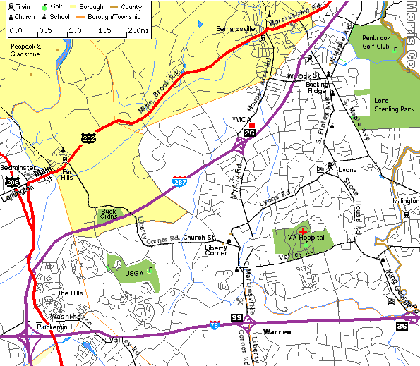
Interactive map at MapQuest | Zoom Out | Martinsville  | Somerset Hills
Weather
Weather at The Weather Channel.
Community
Bernards Township | Basking Ridge at: American Town Network
Yahoo Pages for:
Basking Ridge |
Bedminster |
Bernardsville |
Far Hills |
Liberty Corner |
Pluckemin |
Warren.
Yellow Pages
Basking Ridge
Interactive Maps
Basking Ridge |
Bedminster |
Bernardsville |
Liberty Corner |
Pluckemin |
The Hills |
Warrenvillle
Neighborhood Demographics/Cost of Living
Basking Ridge |
Bedminster |
Bernardsville |
Far Hills |
Warren.
Restaurants
Willie's Tavern \
Genealogy Bernards Township Genealogy Sources
Directions to Liberty Corner Presbyterian Church
45 Church St., Liberty Corner