| Snow Load (wight density) | |
|---|---|
| Tahoe > Weather > Snow > |
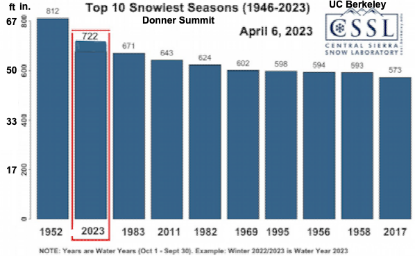
This year was the 2nd snowiest year in the Central Sierra Nevda since 1946.
Many homes were damaged by snow overload.
Last 36 years (1988-2023) sorted by depth (feet):
|
|
|
The difference at Homewood would be even greater, because of more rain and warm weather causing more compaction and water absorption.
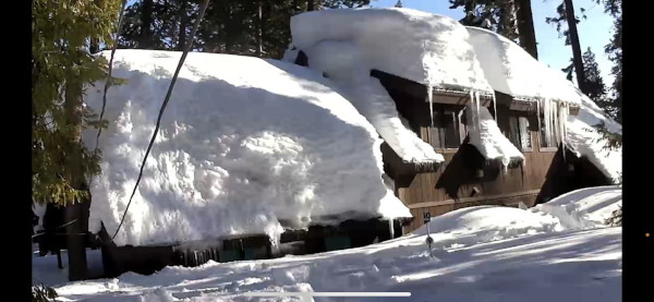
The snow piled up on the north side because of southerly winds blowing it there and lack of sun to melt it. That created a problem in itself with an unbalanced snow load putting more pressure on one side with no opposing force.
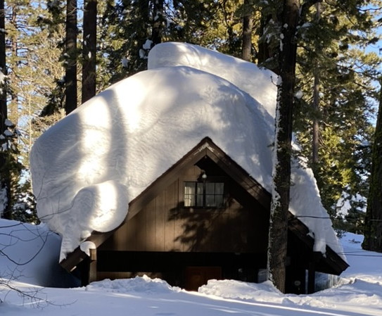
The back roof had 2 icy sections with a total of about 6' and 3' of fresh snow above that. Here's what snow weighs.
snow type	density [lbs/cu ft]
Fresh snow        3.75
Damp fresh snow	  6.87
Settled snow	 15.61
Wind-packed snow 23.41
Very wet snow	 46.82
Ice              57.25
Very wet snow has 25 times the density of fresh snow..
Rain was in the forecast so the top layer would have absorbed all that rain. This is what Dennis and Bob warned me about.
The North Tahoe Fire posted a warning on their website and facebook. Safe Snow Removal | NT Fire facebook "After the storm this weekend and another one on the way, which is looking like a warmer wetter pattern, there are concerns about the wet snow and precipitation adding to the snow load on structures."
I googled around and there were several sites which said you needed to measure the snow density. The easiest was to pound a 3" pipe down to the the roof to get a core sample then melt it into a bucket and weigh it. Those icy sections would have prevented that unless we got a metal pipe and heated it.
Then lookup the building codes to see how much weight your roof was designed to hold.
I used the table above to guesstimate the weight.
If we use 20 PCF (Pounds per Cubic Ft.) as the average for the 6' compacted icy sections
and 40 PCF for the rain soaked 2.5' of soft snow we get (20*6 + 40*2.5) / 8.5'
For an average pf 25.9 PCF.
It took me a while to find the Placer Co. building codes and our location (Section, Township and Range) which they required.
Codes are at:
library.qcode.us/lib/placer_county_ca/pub/county_code/item/chapter_15-article_15_04-part_ii-15_04_290
It required the location Section-Township-Range, and elevation.
I found a web page which overlayed the Public Land Survey System (PLSS) on a google map.

The code for this location is 24.5 PCF, so snow load would have been over spec.
Tahoma colapse
.
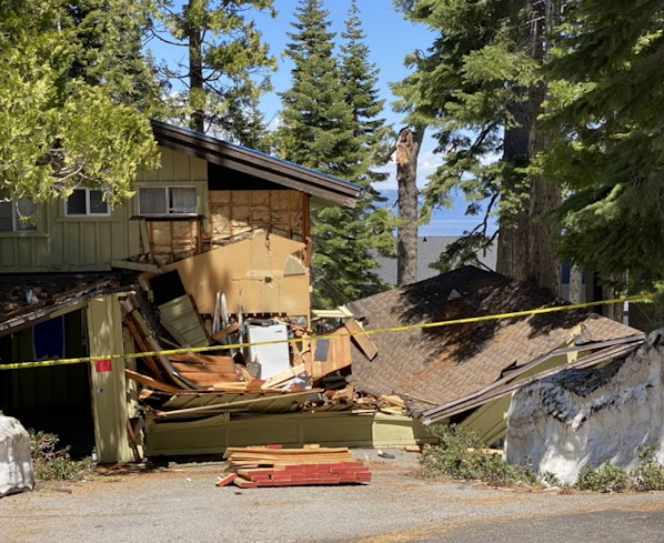
There are a bunch of pictures of roofs like this at Tahoe on the web.
image.png
See https://donsnotes.com/tahoe/snow.html for more snow charts.
Links: Snow on Roofs