|
|
|
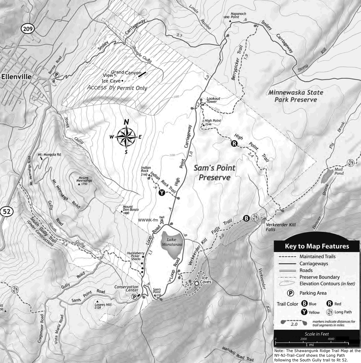
The Sam's Point Preserve is a 4,600-acre nature site on the highest point of the Shawangunk Ridge was purchased by the Open Space Institute (OSI) in 1997. It is operated by the Nature Conservancy.
It is home to nearly 40 rare plants and animals.
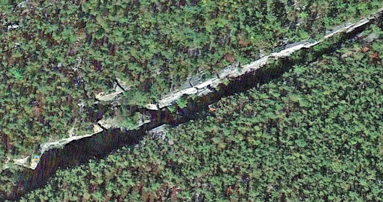
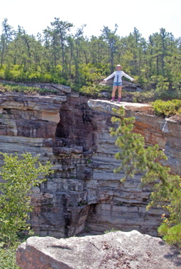
It contains the largest known exposed fault system in the United States, along with a series of ice caves formed from fault debris.
The conservation center is open Thursday through Monday from 9:00 am until 5:00 pm.
The conservation center is open from mid-April through mid-November. Take Cragsmoor Rd of of NY 52 to Sams Point Rd.
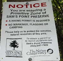
The Smiley Carriageway - Shingle Gully area requires a permit for smaller groups and limits group size to 12. I called at the end of June and the first weekend date available was the end of July.
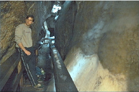
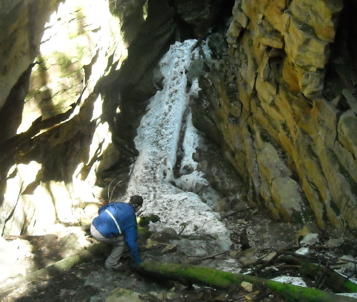
There are several ice caves:
Shingle Gully ice caves. Known also as Ellenville Ice Caves, Cave of Mists, Greater Ice Caves, Greater Ellenville Ice Caves, Noncommercial Ice Caves. Ice Mountain Caves are the "commercial" ice caves. People used to be able to drive to these, and walk through them for $6.50. The caves are really a series of crevices in a cliff, and were not as deep, as narrow, or as cold as the caves in Shingle Gully. They did build ladders, stairways, and walkways through these formations.
Geology: The conglomerate ice caves are quite different geologically from limestone caverns. Throughout the ridge a hard quartz conglomerate, known as Shawangunk Conglomerate, overlies the less competent Martinsburg Shale (Kiviat, 1991). There are several locations where these ice caves exist but the highest concentration is at Sam's Point Preserve. The largest of these caves is in the Shingle Gully Region. These ice caves were produced when conglomerate masses separated along joint cracks leaving deep, canyon-like gaps that range from a few feet to more than a hundred feet across (Fagan, 1998). Source: Shingle Gully Ice Caves Management Plan: Balancing Recreational Use And Senstive Ecosystem Protection | buffalostate.edu - Kirkpatrick
According to www.nature.nps.gov/nnl/docs/NNLBrochure.pdf "a film on the geology of the Ellenville FaultIce Caves NNL has been produced using a
grant from the National Park Service (NPS)
Challenge Cost Share Program. The film
includes actual footage of the site's geological
features combined with computer animation to
demonstrate how specific geological formations
were created." In 2004 a hiker died after falling backward probably in Shingle Gully. Story at "Views from the Top" vftt.org Sams Point - Ice Caves | chayden.net LocalHikes - Sams Point Loop, Shawangunks
Ice Cave Hike Notes from Rob Segal (Word doc)
Ellenville Fault Ice Caves - Ellenville, New York - U.S. National Natural Landmarks on Waymarking.com
Shawangunk Mountains at Ellenville | Harriman Hiker
Links: Ice Caves, Sam's Point Preserve-Cragsmoor, New York | ReadyHiker.com Return to Catskill Hiking
|

 Their
Their