These are primarily outdoor (hiking, biking, swimming) sites.
Search for other Sacramento Area Attractions.
| Place | Distance | miles | Elevation gain | Notes | |
|---|---|---|---|---|---|
| Fiske Pk via Blue Ridge Tr | 1h | 7.5 | 2,395 ft | Cache Creek Regional park | |
| Redbud trail | 1:20 | 6.0 | 1,026 | Near Clear Lake | |
| Homestead to Blue Ridge Loop | 38 min | 5.1 | 1,456 | Stebbins Cold Canyon - S. End of Lake Berryesa | |
| Pierce Canyon Falls | 5.8 | 1,079 | Dunnigan CA |
| Location | Time f/ Davis | Pet Friendly |
|---|---|---|
UC Davis 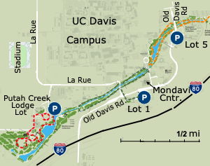 Arboretum and Public Garden 3.7 mi. from end to end Arboretum and Public Garden 3.7 mi. from end to end- Visitor Map The GATEway Project has identified 3 1 mile loops. From East to West they are: Arboretum GATEway Loop - Visitor Parking 5 Environmental GATEway Loop - Visitor Lot 1 UC Davis GATEway Loop - Putah Creek Lodge Parking | 10 min | |
| Putah Creek Wildlife Area, Lake Berryessa - Google Map | 35 min | N |
| Explore Homestead to Blue Ridge Loop | AllTrails 5.1 mi, Stebins Cold Canyon Reserve, Lake Berryessa | 35 min | N |
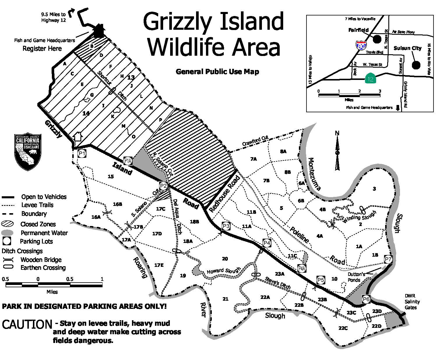
| Grizzly Island Wildlife Area Eastern edge of Suisun Bay - Birding, fishing, hunting, ... Suisun Hill Trail - gate across from Rush Ranch. 1.3 mi. Bay Area Hiker recommends the trail across from Parking Area 3. It's a gravel road for the last 3 miles. Google Map (38.111065, -121.938822) Grizzly Island Wildlife Area Map | 1 hr | |
| Cache Creek Nature Preserve Map | 26 min | |
| Libery Island Ecological Preserve | 40 min | |
| Jepson Prairie Preserve (113 south of Dixon) | ||
| American River Parkway - Jedediah Smith Memorial Trail 28 miles | 40 min | |
| Explore Pioneer Express Trail | AllTrails 14 miles | 40 min | |
| Peña Adobe Hill | AllTrails 3.2 miles out and back, Vacaville - Google Map | 40 min | |
| Cronan Ranch Regional Trails Park – Coloma, California |
| Beach | Distance from Davis | Notes |
| Pismo Beach or its neighbor Avila Beach | 4 1/2 hrs | A slight nod going to Avila due to its lack of seaweed. |
| Marin County Beaches | ||
| Stinson Beach | 2 Hrs | |
| Dillon Beach | 2 hrs | |
| Pt Reyes National Seashore | 2 - 2:20 | Any beach - Pt. Reyes Beach North - Drakes Beach - Visitor Center |
| San Francisco Beaches | ||
| 12 Gorgeous San Francisco Beaches - Baker, Fort Funston, Kirby Cove, Rodeo, Muir, Dunes Beach, Half Moon Bay, ... | San Mateo County - Half Moon Bay, Pacifica, ... | |
| Sonoma County - Bodega Bay | ||
| Mendocino Coast Beaches | ||
| Pt Arena | 3-4 hrs | |
| Mendocino Headlands SP | ||
| Santa Cruz | 2:30 | |
| Sierra Nevada | ||
| South Lake Tahoe | 3 hrs | Several lovely beaches and a bike path along the lake. |
| Donner Lake | 3 hrs | Trail 2/3 of the way around the lake. |
| Local SR-Sacramento River, AR-American River | ||
| Sand Cove Beach (SR) | 20 min | 2005 Garden Hwy, Sacramento |
| Paradise Beach (AR) | 30 min | 5211 Carlson Dr, Sacramento, CA |
| Granite Bay and Beal's Point | 1 Hr | Folsom Lake |
| Riverfront Parks (AR) | ||
Notes:
American River
Comments on Reddit
It's hard to find a nice, secret beach on the American -- most of the places are either jam-packed (Discovery Park or the confluence up by Auburn) or overrun with littering assholes (Sutter's Landing, Paradise Beach).
I mean some days you can drive up 28th street downtown to Sutter's Landing and find some good spots, but you have to get there early!
I'd really recommend taking the drive down 160 south by the Sacramento River for untainted, BEAUTIFUL, and shaded beaches. E.g. Steamboat Beach - Courtland, CA - Yelp
See Responses to where is the best beach on NextDoor:

