Places
California
Putah Creek
Cobb Mountain
Places
California
Putah Creek
Cobb Mountain
| Don's Home
Places
California
Putah Creek
Cobb Mountain
| Contact |
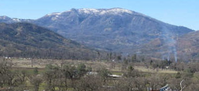

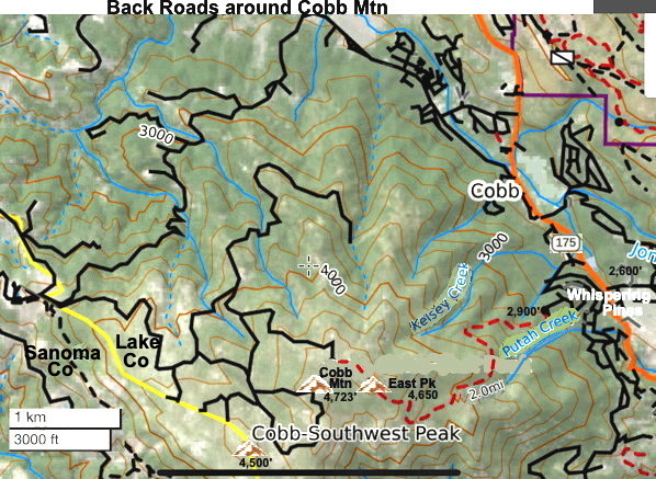
The South-West Peak of Cobb Mountain is on the Sonoma Co. - Lake Co. line south of Clear Lake.
It is tall enough (4,723') to receive winter snowfall. The South-West Peak is the highest point in Sanoma county at 4,500ft.
The east side is the headwaters of Putah Creek which goes to Lake Berryessa then past Davis into the Yolo Bypass and eventually the Sacramento River.
The south slopes of Cobb Mountain drain into Anderson Creek, and thence into Putah Creek.
Much of Cobb Mountain lies within The Geysers Geothermal Field, and several geothermal plants are located on the mountain.
Cobb Mountain and Mount Konocti to the north are ancient volcanoes in the Clear Lake Volcanic field.
It was active from 3 million years ago to 11,000 years ago. The site's threat level is ranked "High" at #33 in the top volcanic threats in the United States.
Putah Creek headwaters are on the East side of the peak at:
Dirt roads around Cobb Mountain - Main, East & SW Peaks
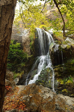
Putah Creek headwaters on Cobb Mountain
3,600' elevation. 600 ft above Pinewood Rd.
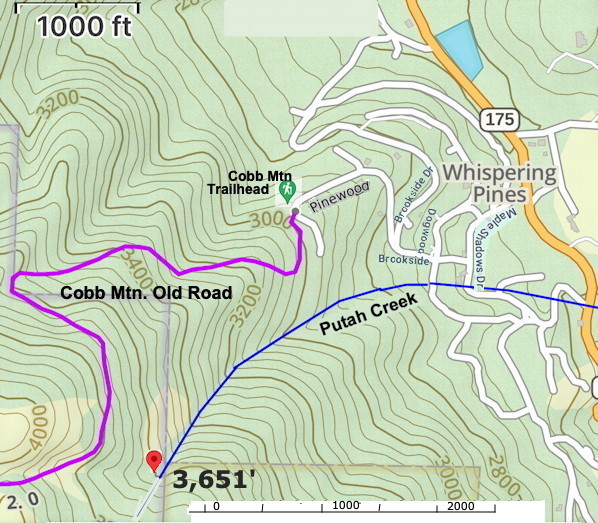
Headwaters - 38°48'26"N 122°43'21"W (38.807222, -122.72211")
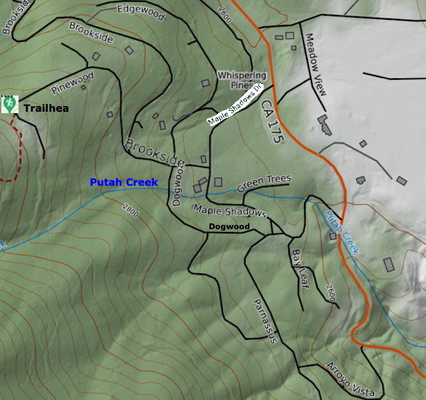
AllTrails Road map
AllTrails.com
The hike to the sumit is 5.5 miles out-and-back with 2,119 ft of elevation gain.