From "Report on a Preliminary Archaeological Investigation of the Alleged Site of the 1777
Summer Encampment of Wayne's Brigade at Middlebrook, NJ",
Wm. Liesenbein, Tucson AZ, 1974
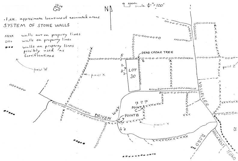
Liesenbein refines Boom's Map by making the distinction between walls probably established by farmers
much later and those which may have been set up in 1777.
Liesenbein refutes many of Boom's claims that many of the walls were used for fortifications, but agree that some may have been. He also found features which he speculates could have been huts and kitchens in 1777.
He concluded that:
At the very least a detailed and thorough history of the entire Revolutionary War occupation of this limited area should be written. This is made necessary by the fact that even if Revolutionary War artifacts are recovered from a given feature, the types and/or proportions of the artifacts in themselves may not be enough to date the feature to the particular period during which it was occupied. The nature of the specific questions raised in the report (particularly the fact that it has not yet enven been proven that Wayne's brigade was camped in the area in which the present archaeologtical investigation was conducted) indicates that this researdch should be done before any further archaeological excavations are conducted."
click on the map to get a larger version suitable for printing.
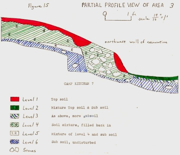
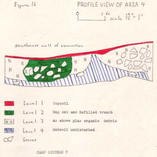
Liesenbein excavated 14 sites in this area.
Summary of findings
Area 1 - 2 - No artifacts. Area 2 depressions possible remains of huts and fireplace.
Area 3 - 4 - No artifacts. Circular depressions  possibly camp kitchen.
Area 5 - 1 piece of iron barbed wire (barbed wire was invented around 1873)
Area 6 - 10 - No artifacts
Area 11 - 12 - No artifacts. Possible garbage pits.
Areas 13 & 14 (not shown on map) - Artifacts indicate structure was constructed after 1790.
square iron nails, glass, brick, cooked bone, coal.
See also: Booms Map, , Scull-Erskine Map
Return to: Middlebrook Encampment