last updated 18 Jan 2020


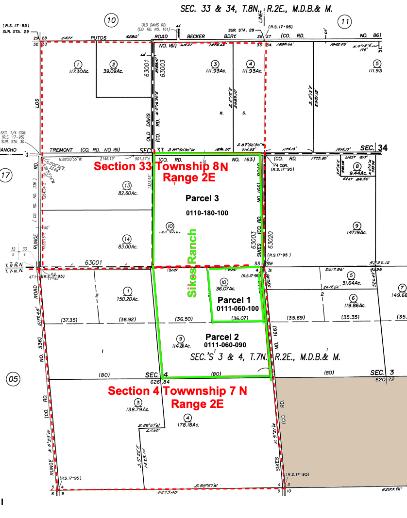
Parcel 1 is where the old house and barns were located.

Description on some deeds is wrong:

  1. E. ½ of the NE ¼ of Section 4, Township 7 N., Range 2 E, Mount Diablo Base and Meridian, according to official plat thereof. Parcel #0111-060-10
  2. W. ½ of the NE ¼ of Section 4, Township 7 N., Range 2 E, Range 2 E, Mount Diablo Base and Meridian, according to official plat thereof. Parcel #0111-060-10
  3. SE. ¼ of Section 33 Township 8 N., Range 2 E, Range 2 E, Mount Diablo Base and Meridian, according to official plat thereof. Parcel #0111-060-10

We will combine Parcel 1 and 2.
Anyway Tax parcels are not necessary in a legal description. So the following legal description is good:

Source: Solano County - Assessor Maps
Note: Do not put "-"s in the Assessment Number According to Chris Rodgers in the accessors office the parcial numbers are not required in a legal desctiption. The following description is sufficient.

The Northeast quarter of Section 4, Township 7 North, Range 2 East, Mount Diablo base and meridian.
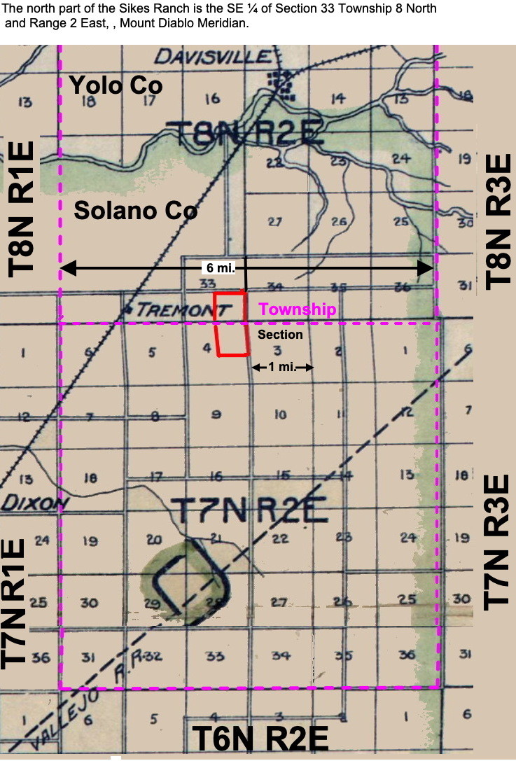
The Southeast quarter of Section 33 Township 8 N., Range 2 E, Range 2 E, Mount Diablo Base and Meridian, according to official plat thereof.


U.S. Public Land Survey System (PLSS) Township and Range:
The country is divided into 6x6 mile townships consisting of 36 1x1 mile sections.
They are described relative to a central point which is Mt. Diablo for Northern California.
Townships are named in reference to a Principal Meridian and a Baseline. A baseline is a horizontal line and meridian is a vertical line intersecting at Mt. Diablo.
The north part of the Sikes Ranch is the SE ΒΌ of Section 33 Township 8 North and Range 2 East, , Mount Diablo Meridian. Meaning it is the 8th township north of the meridian and 2nd townshipo east of the meridian.
Assessor Maps

See:
Understanding Township and Range