Mt. Tallac

According to Mike White's "Afoot and Afield Reno-Tahoe", "Many regard Mt. Tallac as the quintessential Tahoe peak. 'Tallac' is a Native American word meaning 'Great Mountain'."
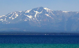
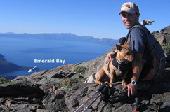
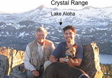
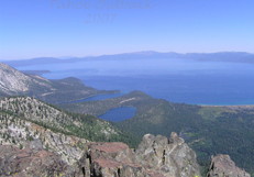
The Tahoe Sierra says, "Of all the significant peaks you can climb by trail, Mt. Tallac is the closest one to Lake Tahoe's shore. Consequently your lake view is truly exceptional."

A party in good condition should plan no less than 6 hours for the round trip, while those in only moderate condition should leave themselves 8 or more hours.
Bring a lot of water on this trail. The climb to the summit can get very hot in summer, and much of the trail (including the steepest part) lies above timberline, where you are exposed to the relentless sun.

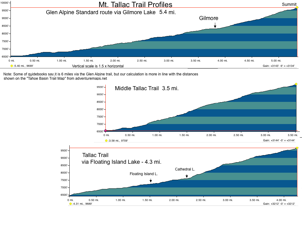
I'v added trails from a variety of maps, books and Internet sources to the map below, so as far as I know it has the most complete set of trails available.

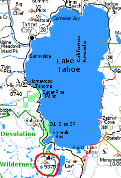
                       North West Lake Tahoe
mt. tallac, trails,
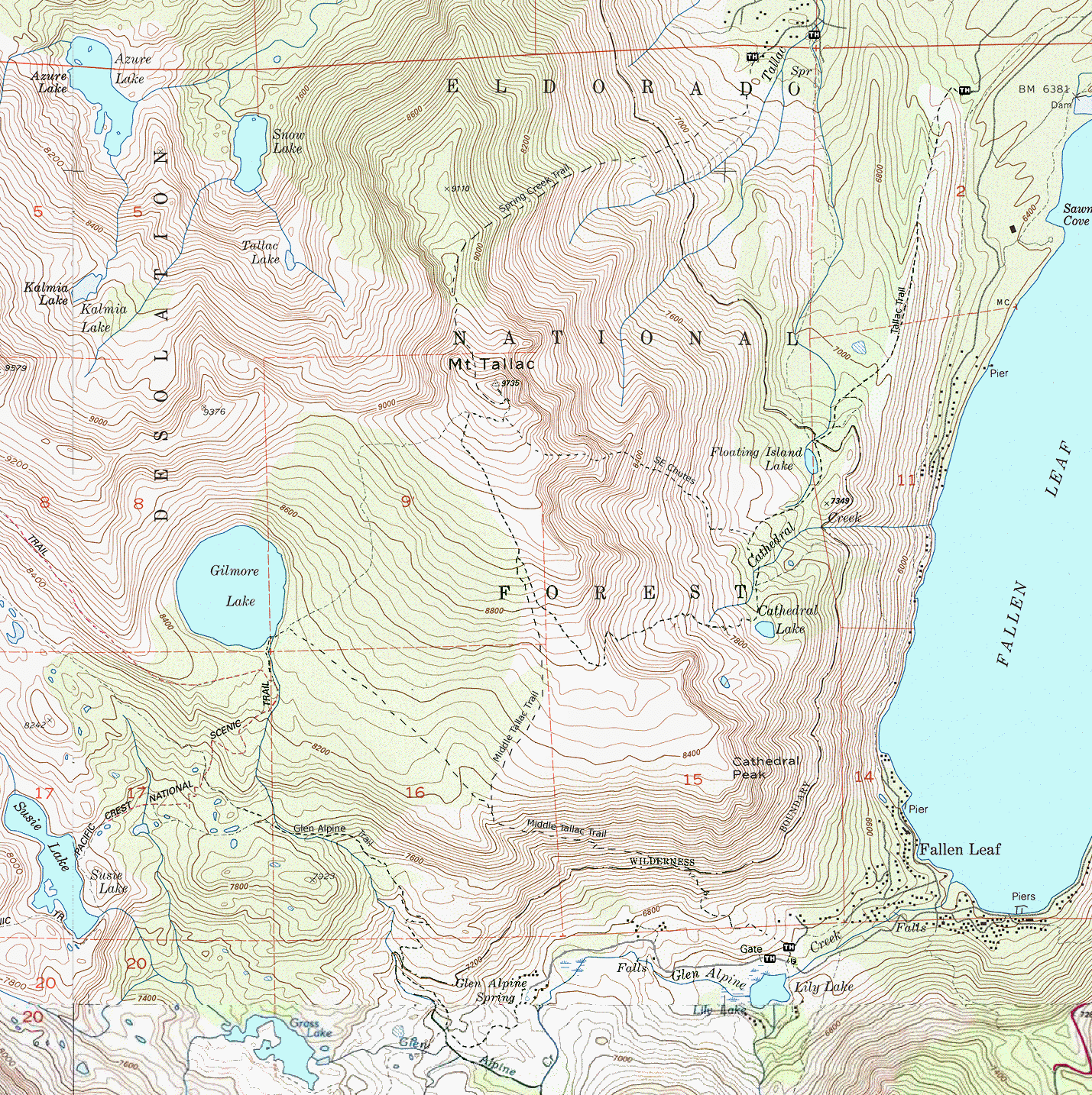
Zoom out    (May need to print at 75% to fit in 1 page)
Different maps and guides have different names for the trails.
Trail Dist-
ance *
Trailhead Notes
Glen Alpine 5.3 Lilly Lake- Take Fallen Leaf Lake road to the south end of the lake. Connects to Pacific Crest Trail and then cuts off to Gilmore Lake.
Middle Tallac 3.5 Lilly Lake Heads up the tallus slope on the north side of Glen Alpine Canyon.
Tallac Trail
(Floating Island Trail)
4.3 Mt. Tallac Rd. A. Take Camp Shelly/Tallac City Camps turn-off on Hwy 89 and follow signs to Tallac Trailhead.
SE Chutes 3 Mt. Tallac Rd. If you are fit, adventurous, good on your feet, you can peel off the main trail in the clearing about 0.2 miles before Cathedral Lake. From this point, an easy 100 yard bushwack to the NW heads towards a seasonal creek leading up to a steep slope of fairly large talus.
Spring Creek †
NE Ridge
5.5 Spring Creek Road Winter route that minimizes travel in avalanche zones.
*Distance - Miles one way.
† - Some maps show the Spring Creek Trail connecting with the Floating Island Lake trail.

See The Descent at TahoeAdventureSports.com for skiing down:

  • Corkscrew: North Bowl - The easiest and most common descent down into the trees at the top of the broad valley just to the south of the ridge you ascended.
  • The Cross: Just south of the summit. The first 30-40 feet is free-fall through a chute 15 feet wide. This "widens" into a 50 degree slope that is maybe 30 feet wide for the next 100 feet. (Sounds like Warren Miller time)
  • South Bowl: In the spring, the South Bowl is a favorite descent.
See:
Mount Tallac Ski Tour at TahoeBackCountry.net
Skiing Mt Tallac North Bowl Lake Tahoe | Skiing The Backcountry
www.TheBackCountry.net : Mt. Tallac Thread 2008 and 2009
Rachid Dahnoun Photography: Skiing and Snowboarding The Cross on Mt. Tallac in Lake Tahoe, CA

mt. tallac trail profiles


See Tallac Adventure from our July 4th adventure to watch the fireworks around the lake from Mt. Tallac.

Maps
The Mount Tallac page at TahoeAdventureSports.com has the most complete set of trails
Tahoe Backcountry has other routes.


Return to: Tahoe West Shore Information : Tahoe Maps Visitor Center