Source: California Tahoe Conservancy (tahoe.ca.gov)
Derived from: esri (GIS mapping), Watershed Sciences (WSI), USGS
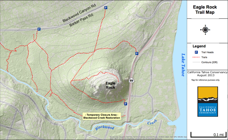
1.5 miles round trip
1 hour
250 feet elevation gain
Eagle Rock is an eroded, dormant volcano.
From the top are panoramic overlooks of Lake Tahoe.
There are three trailheads.
1. 0.25 mi. from Hwy 89 on Blackwood Canyon Rd. (Barker Pass Rd.)
   Follow the power lines crossing the road.  There will be Eagle Rock signs on the way up.

2. On Hwy 89, 0.25 miles south of Blackwood Canyon Road.
      There is a pull out on the west side of the road.

3. On Hwy 89, 0.4 miles south of Blackwood Canyon Road.
     There is a pull out on the west side of the road.
In 2012 there was a beaver dam just upstream from the campground.See Blackwood_Creek_(California) in wikipedia.
Links:
Day Hikes around Lake Tahoe Guide Book | trails.com