Under Construction 
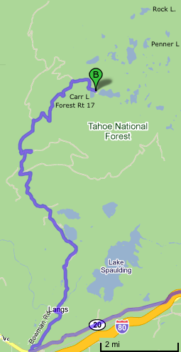
Carr Lake Trailhead:
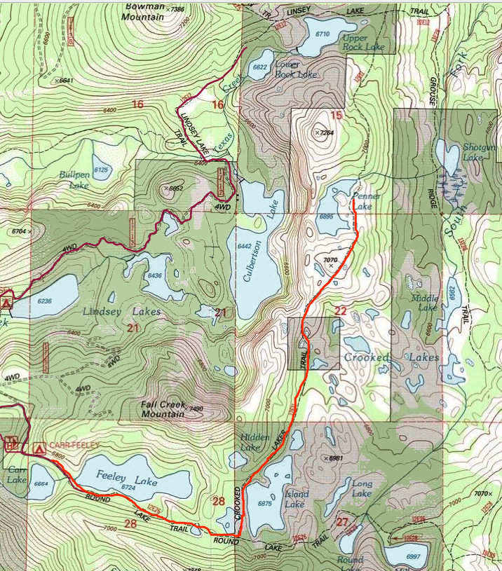
The Crooked Lakes Trail to Penner Lake is one of the most scenic and popular hikes. The trail follows along the west shore of Island Lake and climbs by Crooked Lakes (shallow, but trout slip out of upstream lakes into them) and on to dramatic Penner Lake (stocked with Kamloops Junction rainbow trout in 2000). Scramble up rocky ridge west of Penner for dramatic look back down to Culbertson and Lindsey Lakes basin.
See: Crooked Lakes Trail to Rock Lakes via Penner Lake at SierraOutdoorRecreation.com Contacts: | |||||||||||||
Greater Tahoe Area Yuba River Ranger District (North Yuba river, Yuba Pass, Gold Lakes Basin, I-80 corridor, Hwy 20, Bowman/Grouse, Cisco Grove areas) 15924 Highway 49 Camptonville CA 95922 530.288.3231 or 478.6253 (voice) |
Nevada County Sheriff's office : Emergency Dispatch: 530 265-7880 950 Maidu Avenue, Nevada City CA 95959 - 530-265-1218 | ||||||||||||
Links:Carr Lake Campground at PublicLands.org SierraOutdoorRecreation.com: Carr Lake Crooked Lakes Trail to Rock Lakes via Penner Lake | |||||||||||||