Don's Home Reference Geography US Public Land Survey System (PLSS)- Township and Range (T&R) Contact
last updated 21 June 2021

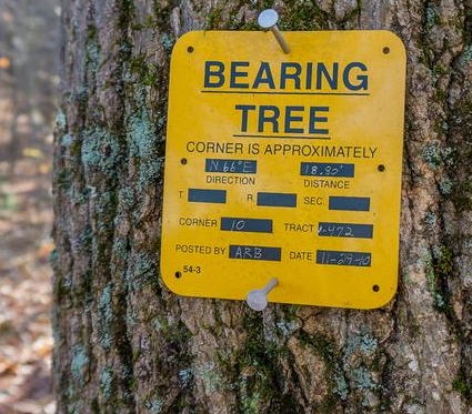
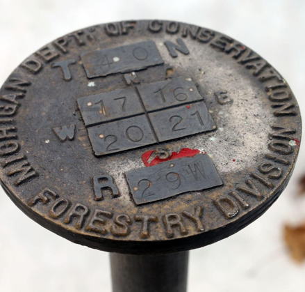
U.S. Public Land Survey System (PLSS) Township and Range:
The country is divided into 6x6 mile townships consisting of 36 1x1 mile sections.
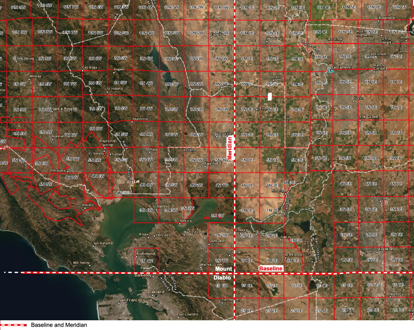
They are described relative to a central point which is Mt. Diablo for Northern California.
Townships are named in reference to a Principal Meridian and a Baseline. A baseline is a horizontal line and meridian is a vertical line intersecting at Mt. Diablo.
Below is for the location of our family farm, The Sikes Ranch, which has 2 contiguous ¼ sections in two different townships.


Because the survey design is two-dimensional (rectangular), while the actual earth is three-dimensional (approximately spherical and topographically), adjustments to land areas must be made periodically to prevent error propagation; not all sections can be one square mile nor can all townships be exactly 36 square miles. More specifically, all north–south running lines (all range lines and half of all section lines), as with the prime meridian, are always established with reference to true, geodetic north. But it is a physical impossibility to meet this condition and still maintain a rectangular land grid, because such lines converge on the north pole.

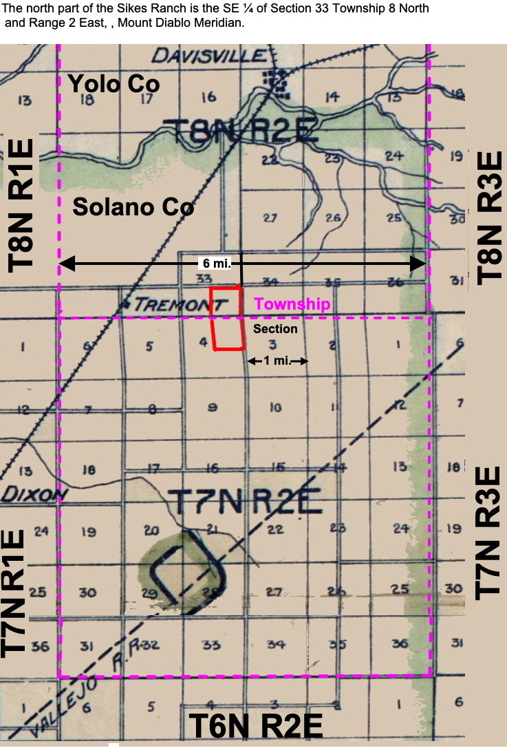
To accomodate this some sections are allowed to deviate from one square mile.
There were other deviations to compensate for surveying errors.
You can see this in sections 1-6 in Township 7 North which includes the southern section of the Sikes Ranch which are a parallelograms not an exact square.
This is because the northern part of the state was surveyed starting from Mt. Shasta going south and the souther part was from Mt. Diablo going north and they did not meet exactly here.


Mount Diablo in California at W 121° 54.845. Established under the U.S. Public Land Survey System, it is used to describe lands in most of northern California and all of Nevada. Mount Diablo also marks the baseline at latitude 37°52'54"N.

Click to enlarge

Source: PLSS Map Viewer |arcgis.com

Tahoe PLSS


Notation:
A description would read:
"T1SR20E S13 MDM" reads as follows: Township 1 South, Range 20 East, Section 13, Mount Diablo Meridian.
You will find small markers with Township and Range on trees called bearing trees with directions to a corner and on corner markers on posts in the Sierra Nevada.
 
Links:
Understanding Township and Range
Public Land Survey System - Wikipedia
Map of Napa & Solano Counties Cal. | Library of Congress
Map, Compass and grid coordinate systems in hiking and camping here.