Zoom out
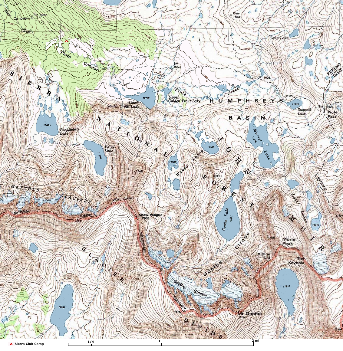
GPS Coordinates:
Alpine Col	 37.21483 	 -118.69466 	 12,243 	 Class 2. Talus and loose rock. Go around the east side of Lake 11,910.
The Keyhole	 37.21444 	 -118.68777 	 12,527 	 Class 2. Short Class 3 on SW side. Hike around the east side of Lake 11,910.
Piute Pass	 37.23901 	 -118.68408 	 11,402	Class 1
Snow-Tongue Pass 	 37.22147 	 -118.72202 	 12,172 	 Class 2-3. Sierra
Alpine Col	256203	Gap	Fresno	CA	371251N	1184139W	12182	Mount Darwin	 - 	19-JAN-81
The Keyhole	268197	Gap	Fresno	CA	371252N	1184113W	12483	Mount Darwin	 - 	19-JAN-81
Pilot Knob	264735	Summit	Fresno	CA	371625N	1184526W	12221	Mount Hilgard	 - 	19-JAN-81
Goethe Cirque	252143	Basin	Fresno	CA	371300N	1184203W	11745	Mount Darwin	1949	01-AUG-90
Pilot Knob	264735	Summit	Fresno	CA	371625N	1184526W	12221	Mount Hilgard	 - 	19-JAN-81
Desolation Lake	259287	Lake	Fresno	CA	371627N	1184220W	11381	Mount Tom	 - 	19-JAN-81
Lower Desolation Lake	263011	Lake	Fresno	CA	371535N	1184227W	11188	Mount Tom	 - 	19-JAN-81
Reference: Mono Divide High Country Trail Map (1 in = 1 mi) and Bishop Pass Map (1 in = 0.75 mi) at Tom Harrison Maps Humphreys Basin Complete Trail Guide, at trails.com, which is a chapter from "Sierra South" from Wilderness Press. Yosemite & The Southern Sierra Nevada: A Complete Guide, Including Sequoia & Kings Canyon, Death Valley & Mammoth Lakes (Great Destinations) by David T. Page High Sierra Passes at SierraBackpacker.com Return to Southern Sierra Nevada or Humphreys Basin Outing
| ||||||||||||||||||||||
