History
Middlebrook Encampment
History
Middlebrook Encampment
Middlebrook Washington Rock
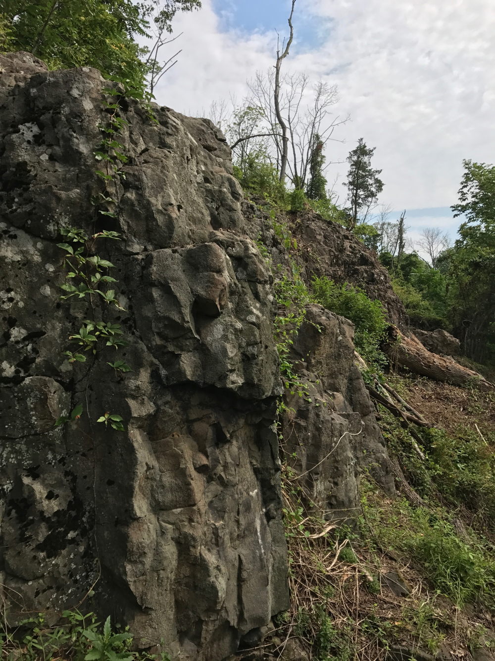
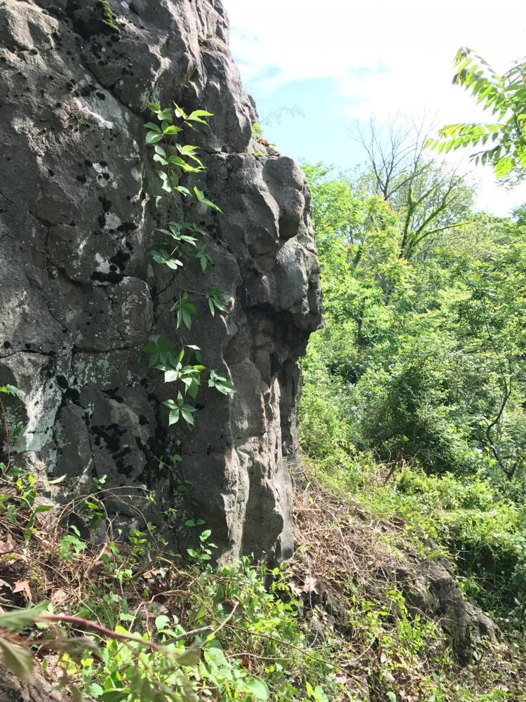
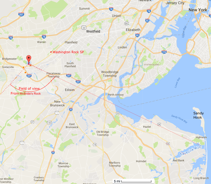
McBride's Rock
40.5815,-74.5438
These are several different observation points along a 150 ft area of the 20 foot cliff.
(Click on pictures for a larger version)
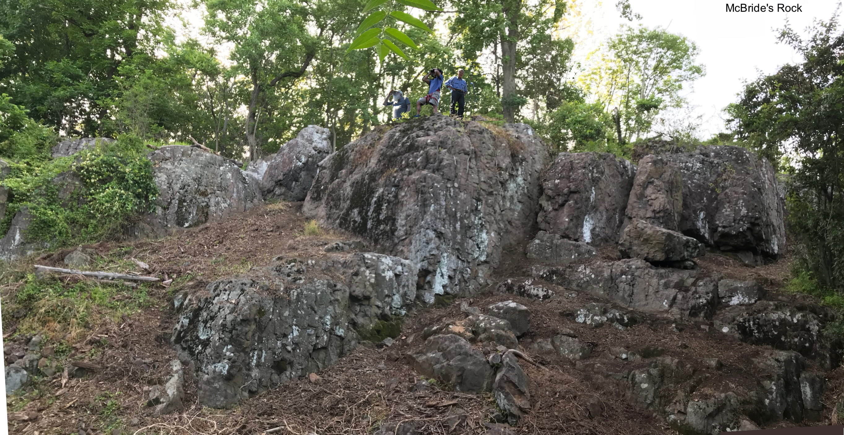
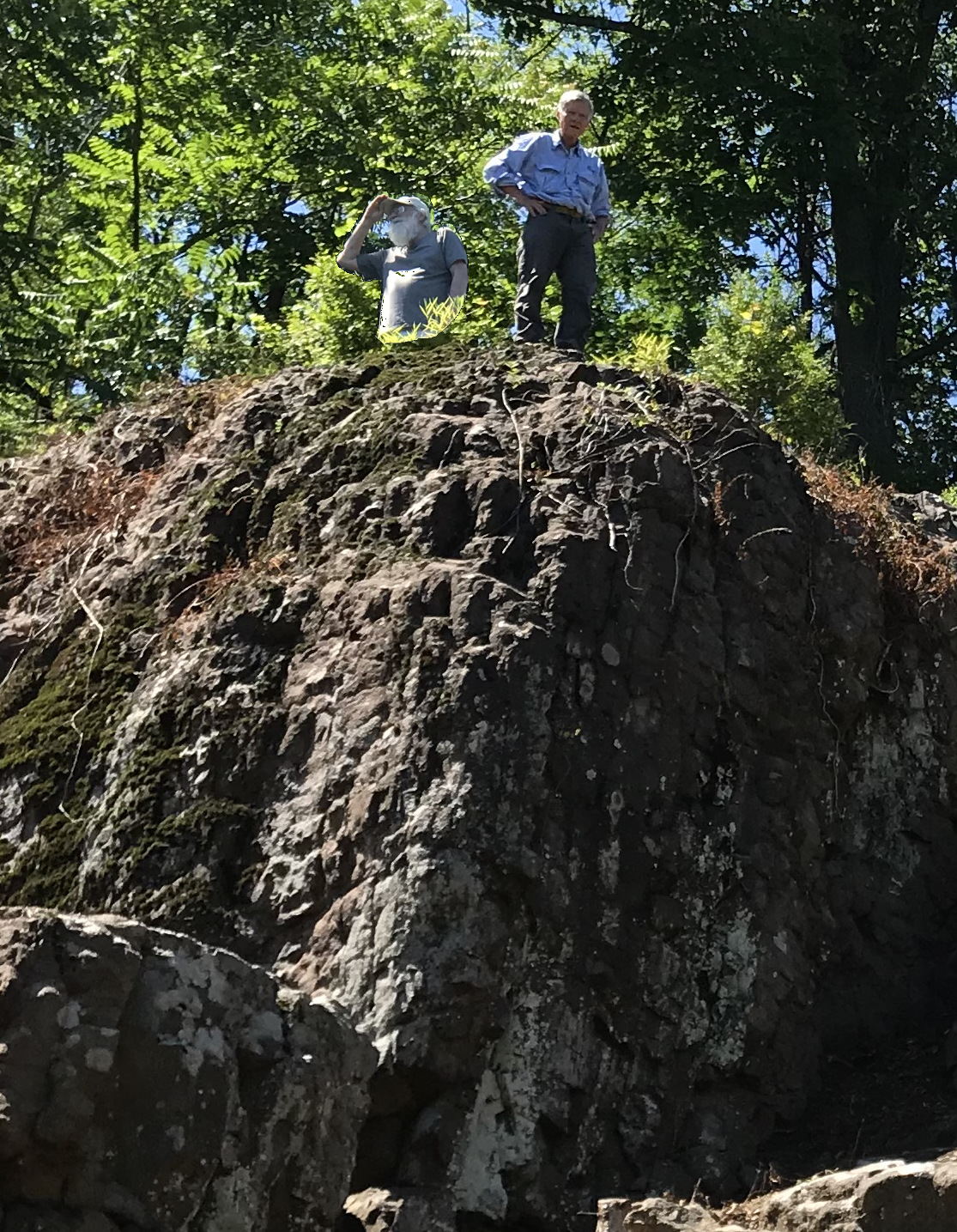
David McRitchie and Me. (David helped clean up the site)
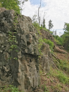
Looking along the face


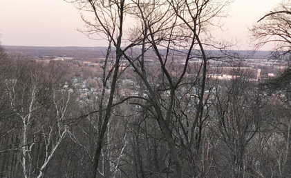
View south towards New Brunswick
SE Face Middle Wall Trail Below.


Case for McBride Rock:
Rock formations look more like Lossing's drawings.
It is a higher location (375') vs the chimney rock location (315').
Closer to the road thru Wayne's gap (Vosseller Ave.)
Provides a better view thru Wayne's gap.
That is where General Wayne's Brigade was camped.
I walked below the ridge for 1/4 mile on either side of Vosseller Ave and didn't see any better location.
Neither location has a view of the valley in the background to the right when looking across the rock face like the sketch.
Field of view from Vosseller Ave Rock (B)
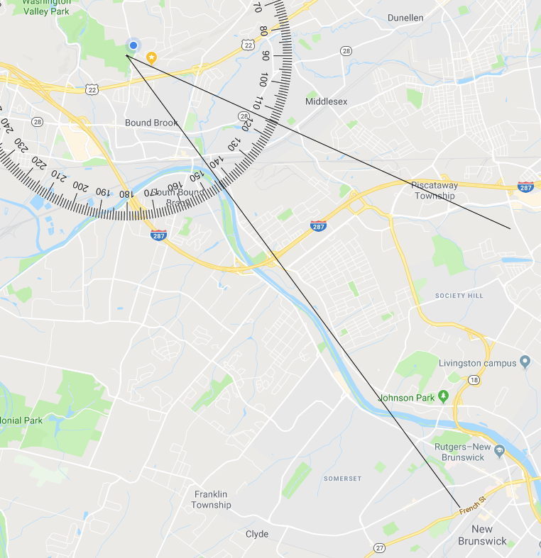
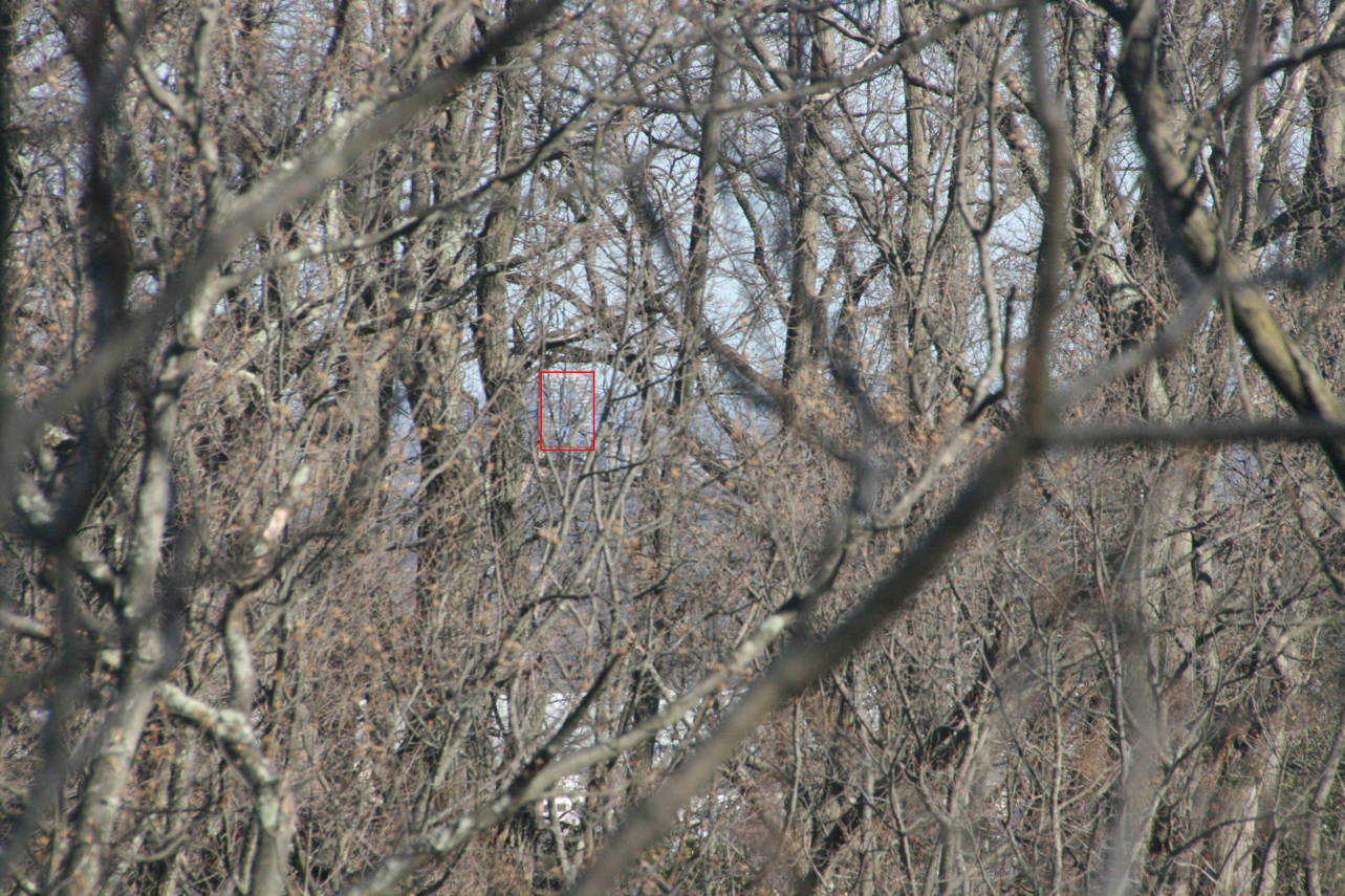
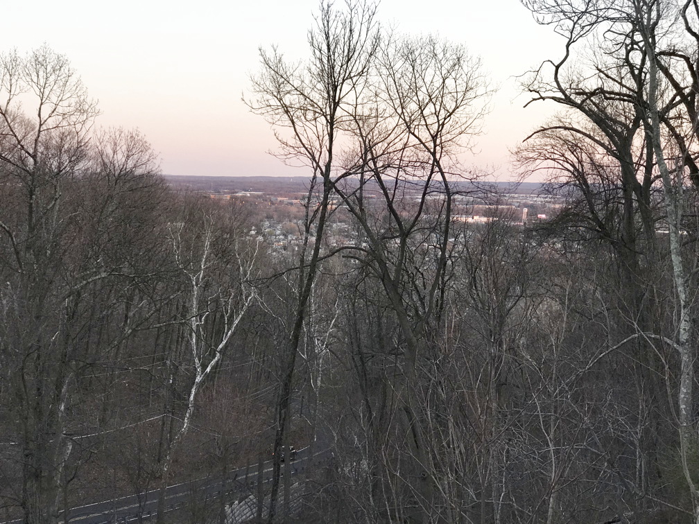
Note: You can move about 100 yards down the ridge to get a view of Sandy Hook in the winter when there are no leaves.
The field of view is for the winter when there are no leaves. We assume Washington's army with nothing to do, would have cut down any trees blocking the view.
Note: The only place where you can see the valley below when looking across the rock face is at the first picture above in "View along rock face", but the cliff is on the right. I think Lossing took a little license in the illustration.
Picture looking east in the winter without trees. You can see buildings father to the east. I'd guess that Washington's army would have cut down some of these for a better view.