|
Day 1: Met at the Clair Tappaan Lodge (CTL) at 4 p.m. for introductions.
After dinner Susan went over the planned itinerary.
Spent the night there at an elevation of 6,960 to get acclimatized.
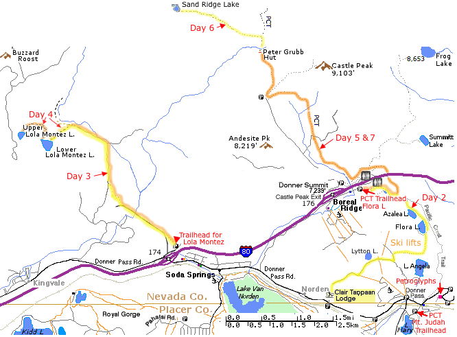
Day 2: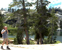 Drove to the Pacific Crest Trail (PCT) trailhead off I-80 at Boreal Ridge/Castle Pk
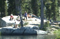
and hiked to Flora Lake, 1.5 miles. Several people took a dip in the inviting water. Don gave a map and compass course.
Drove to the Pacific Crest Trail (PCT) trailhead off I-80 at Boreal Ridge/Castle Pk
and hiked to Flora Lake, 1.5 miles. Several people took a dip in the inviting water. Don gave a map and compass course.
Some people went back to the cars at the PCT trailhead and others went cross country back to CTL, 2.5 mi [330 ft elevation gain]. Topo
We went back to CTL, where we practiced setting up tents.
Susan and Penny showed what they carried and how they packed.
After Dinner we visited a local petroglyph sight for a talk by a Forest Service Ranger.
Day 3:
 After breakfast we drove across I-80 to the Lola Montez trailhead and hiked approximately 3.5 miles Lola Montez (7,160') [gross elevation gain 705']. where the dinner crew cooked dinner, while John, Gottfried and Erin tried to use a system Don claimed had worked on his last trip to toss a line with a hard rubber ball over a tree limb to haul up a bag for bear proofing.
The ball was not heavy enough to pull the line down and required a considerable amount of coaxing.
After breakfast we drove across I-80 to the Lola Montez trailhead and hiked approximately 3.5 miles Lola Montez (7,160') [gross elevation gain 705']. where the dinner crew cooked dinner, while John, Gottfried and Erin tried to use a system Don claimed had worked on his last trip to toss a line with a hard rubber ball over a tree limb to haul up a bag for bear proofing.
The ball was not heavy enough to pull the line down and required a considerable amount of coaxing.
 We decided a rock in a small sack (recommended in one of the books) would have worked better, although there would be safety issues with an errant rock toss. We decided a rock in a small sack (recommended in one of the books) would have worked better, although there would be safety issues with an errant rock toss.
We finally got it to work with a pulley system described at donsnotes.com/recreation/bear-proof-campsites.html
Topo Map. | Web page.
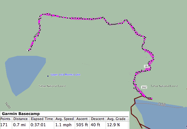
Day 4: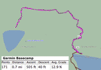 After breakfast, some people hiked to upper Lola Montez, which required some steep rock scrambling. John and Nita jumped in as soon as we arrived. When Don scouted the trail last year his GPS said it was 0.6 mi. but everyone thought it was longer. He went back and checked it and traced the route in another software package. They were right. It was 0.7 mi. with 500 ft of elevation gain . After breakfast, some people hiked to upper Lola Montez, which required some steep rock scrambling. John and Nita jumped in as soon as we arrived. When Don scouted the trail last year his GPS said it was 0.6 mi. but everyone thought it was longer. He went back and checked it and traced the route in another software package. They were right. It was 0.7 mi. with 500 ft of elevation gain .
We departed camp and hiked 3.5 mi. [200 ft net vertical] back to our cars and a shower and beds at CTL.
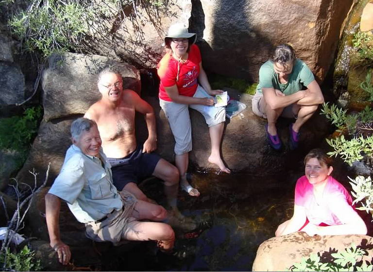
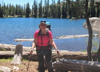
 Day 5: After breakfast, we drove back to the PCT trailhead where we started on day 2 and hiked north up to Peter Grubb Hut at 7,800 ft. 4.5 miles [680 ft vertical]
People found campsites to the west of the Hut out of sight.
Castle Creek was lower than last year making it difficult to get a clean bucket of water.
John scouted the creek and found a great little pool the size of a hot tub with a waterfall. Some of us took a dip.
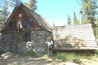
 After dinner we left most of our supplies (Food, stoves, pots, bear canisters) in the hut and retired to our tents.
Don woke up about 7 to start the stoves for coffee and found some thru hikers sleeping in the hut. They noticed all the supplies with no people and started speculating about what disaster had befallen us. One had a sledge hammer he found in the hut next to his sleeping bag to fend off the potential gang who had done away with us.
Topo Map
 Day 6: Layover day.
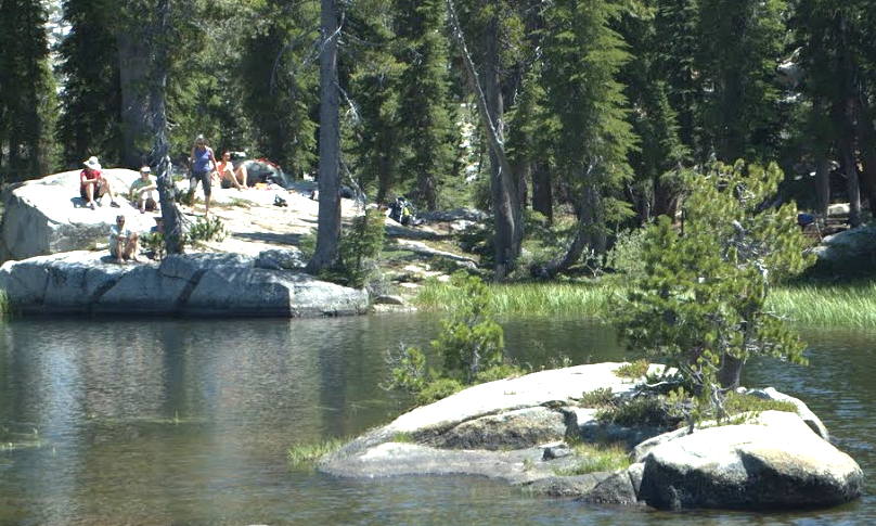
We hiked to Sand Ridge Lake, 3 miles round trip, with about 240 ft. of elevation loss and gain in each direction.
Topo Map.
Day 7: After breakfast, we broke camp and backpack back to the trailhead. Return to CTL for lunch and an opportunity to shower before heading home.
last updated 11 Aug 2012
|